
Our Trail Rating
When a friend told us he had a couple of extra spots on a single-day permit for Mount Whitney, I said yes before I really understood what that meant.
At the time, I had no idea what I was getting into. I didn’t know the hike was more than 22 miles round trip. I didn’t know it climbed over 6,600 feet. I had never heard of the “99 Switchbacks.” And I definitely didn’t realize how hard the hike would be—or how satisfying it would feel to reach the summit.
My wife Alicia said we should do it. I reluctantly agreed. Then the preparation began.
Preparing for the Tallest Mountain in the Lower 48
Once we committed, we started hiking as much as we could.
Some hikes were short—just a mile or two. Others stretched past ten miles. Some were flat. Others were steep enough to make us question our life choices. We hiked at low elevations around 2,000 feet and sought out higher peaks above 10,000 feet whenever possible.
The goal wasn’t perfection. It was simply time on the trail.
We also spent plenty of time researching the hike. We watched videos, read blogs, and talked to people who had already climbed Whitney. Interestingly, several people had done the hike—but none of them had attempted it in a single day.
So I kept telling myself something simple: I’ll go as far as I can go, but no farther.
In my mind, I had already decided how the hike would end. I figured I’d get most of the way up the mountain, then step aside and wait while my friends finished the climb.
Fortunately for me, It didn’t quite work out that way.
From Desert Floor to Mountain Trailhead
The day before the hike we began the long drive toward the eastern Sierra.
We passed through Las Vegas and continued north along Highway 95 toward Death Valley National Park. Driving through the lowest place in North America while knowing we’d soon attempt the highest peak in the contiguous United States was a little intimidating.
From there we passed through places like Stovepipe Wells and Panamint Springs before eventually reaching the small mountain town of Lone Pine.
Dinner that night was simple but memorable. We stopped at the Whitney Restaurant, where a burger helped calm my nerves before the climb. One of my friends ordered a tuna melt. I’m sure it tasted fine at the time—but he came to regret that decision the next day on the trail.
From Lone Pine it’s a steep drive up to Whitney Portal, the starting point for the hike.
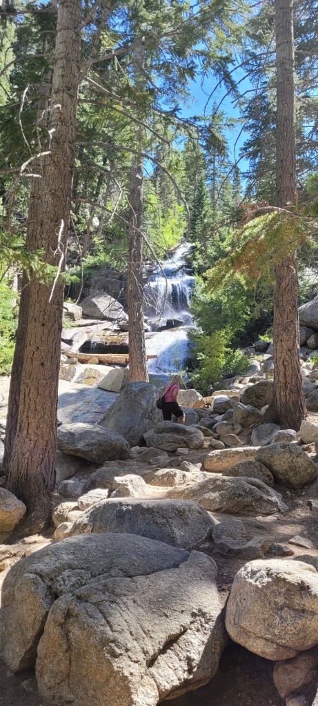
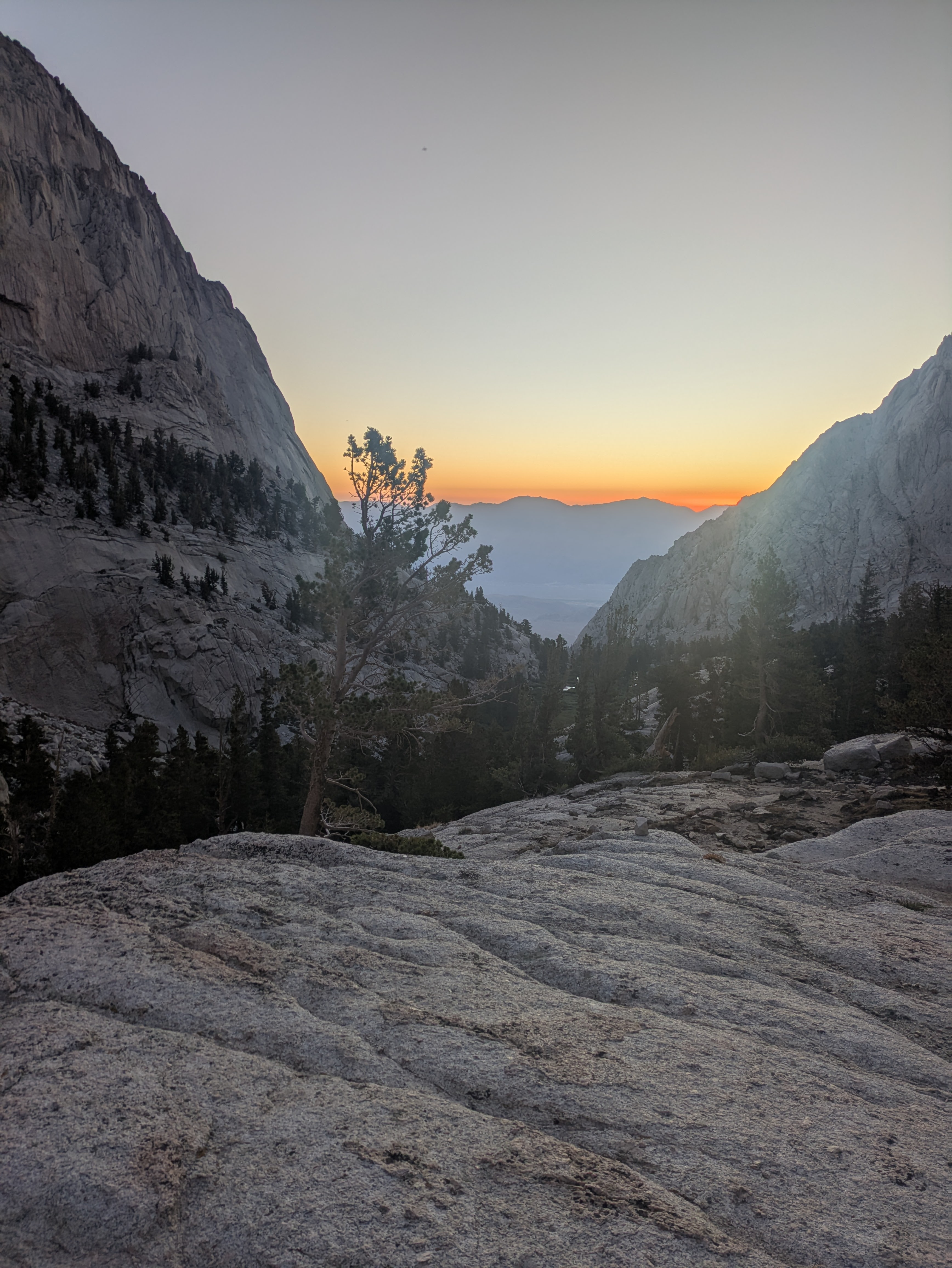
The setting is incredible. After driving through miles of barren desert, you suddenly find yourself surrounded by pine trees, granite cliffs, and cool mountain air. A creek runs through the campground, and towering peaks rise straight above the valley.
It’s easily one of the best public campgrounds I’ve ever stayed in.
But we weren’t there to relax.
We set up our tent and tried to get some sleep because our alarms were set for 3:00 a.m.
A Rough Start in the Dark
We hit the trail shortly after 3 a.m., headlamps lighting the way.
About half a mile in, we realized someone had forgotten their lunch back at the truck.
So there we stood on the trail in the middle of the night while one member of our group jogged all the way back to the trailhead parking lot. It wasn’t exactly the start we had planned, but eventually we regrouped and continued climbing.
The first few miles passed quickly in the dark.
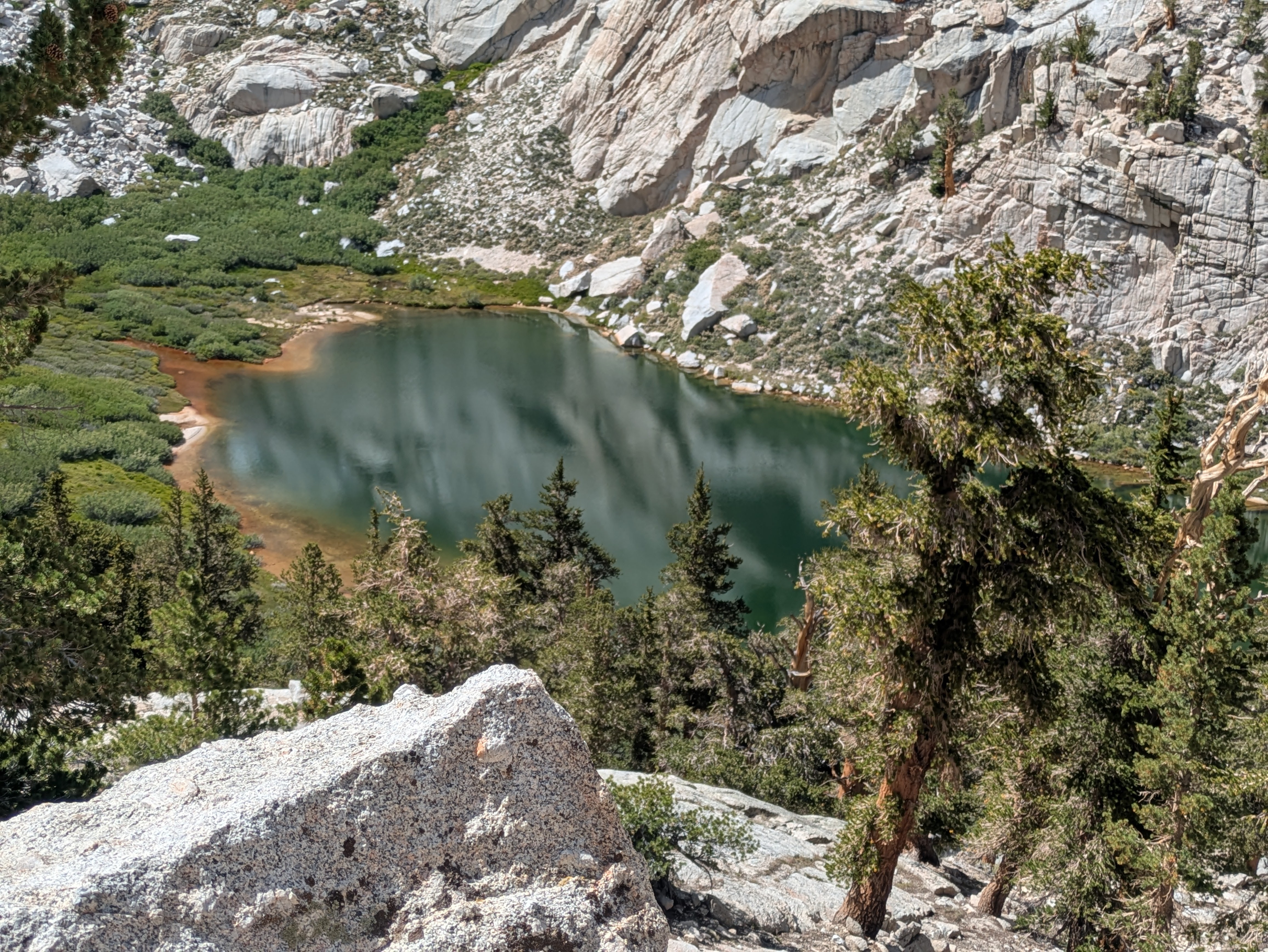
At about 2.3 miles we passed Lone Pine Lake. A little farther up the trail we reached Outpost Camp around mile 3.8. Both places are beautiful—but at that hour we could barely see them.
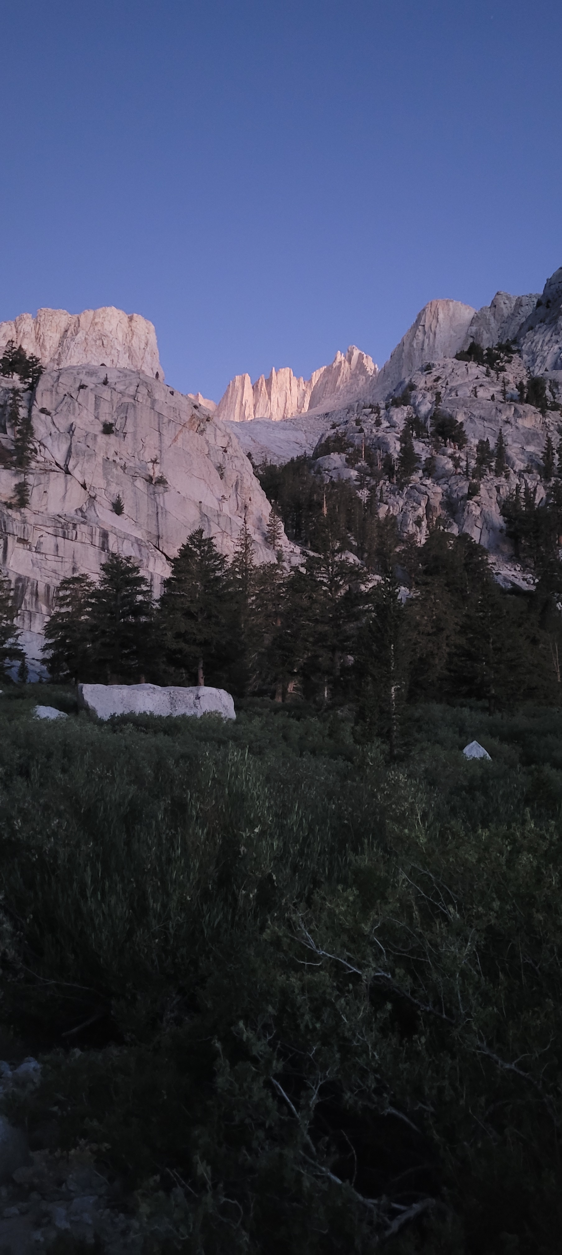
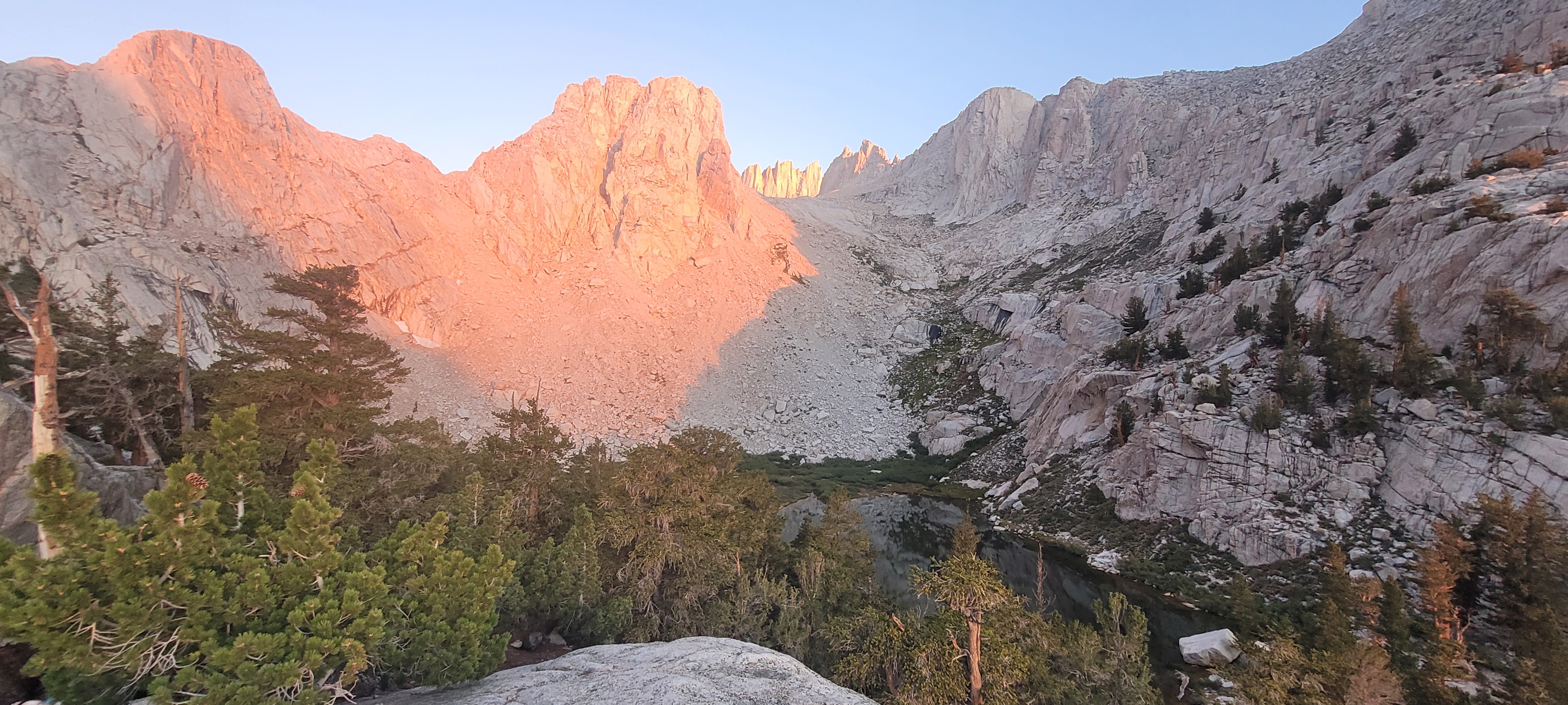
As the sky slowly brightened over the Sierra Nevada, the trail continued climbing toward one of the most important landmarks on the route: Trail Camp.
Trail Camp and the 99 Switchbacks
By the time we reached Trail Camp, we were sitting at roughly 12,000 feet.
This is where many overnight hikers camp before attempting the summit the next morning. It’s also the last dependable water source along the trail, which makes it an important stopping point for day hikers as well.
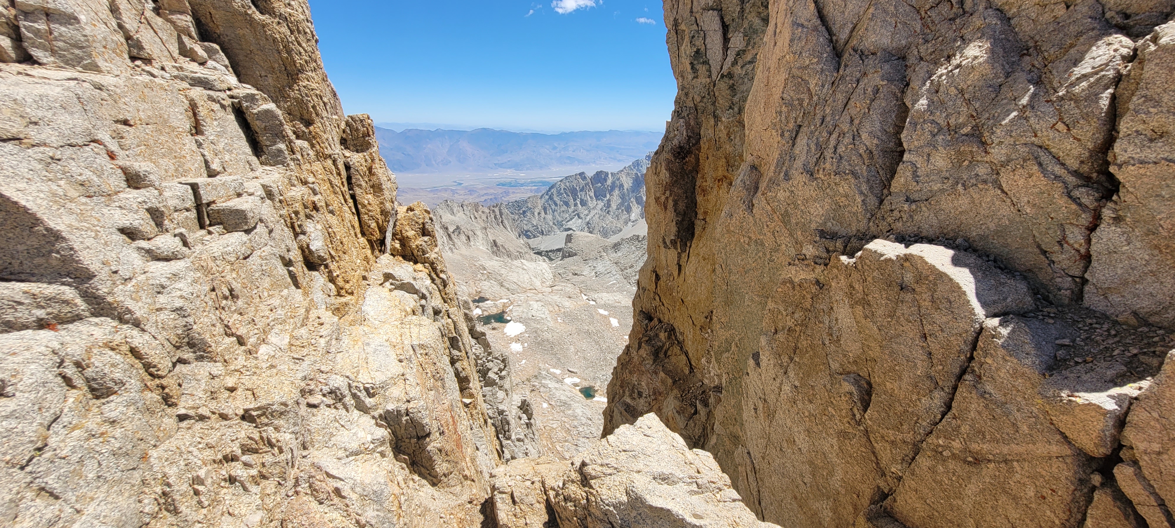
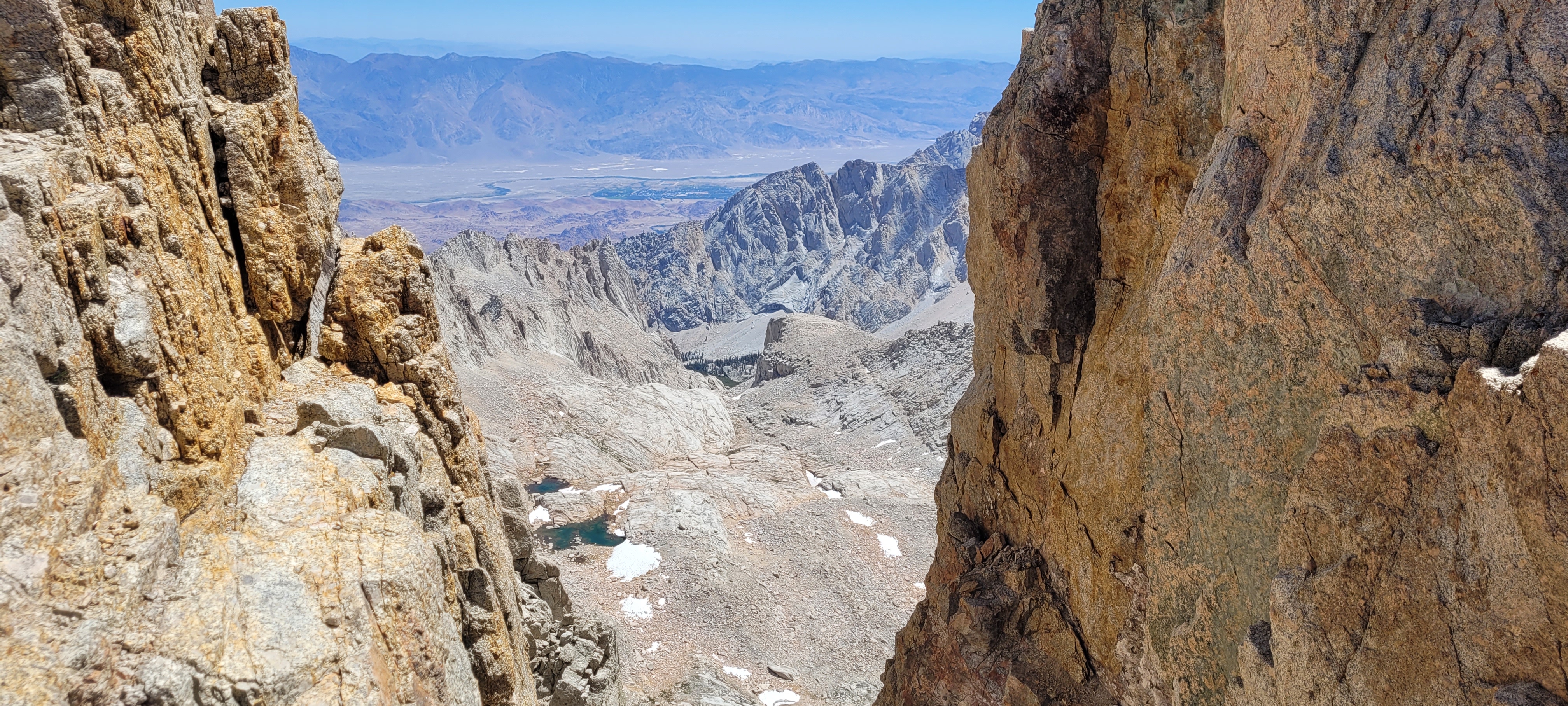
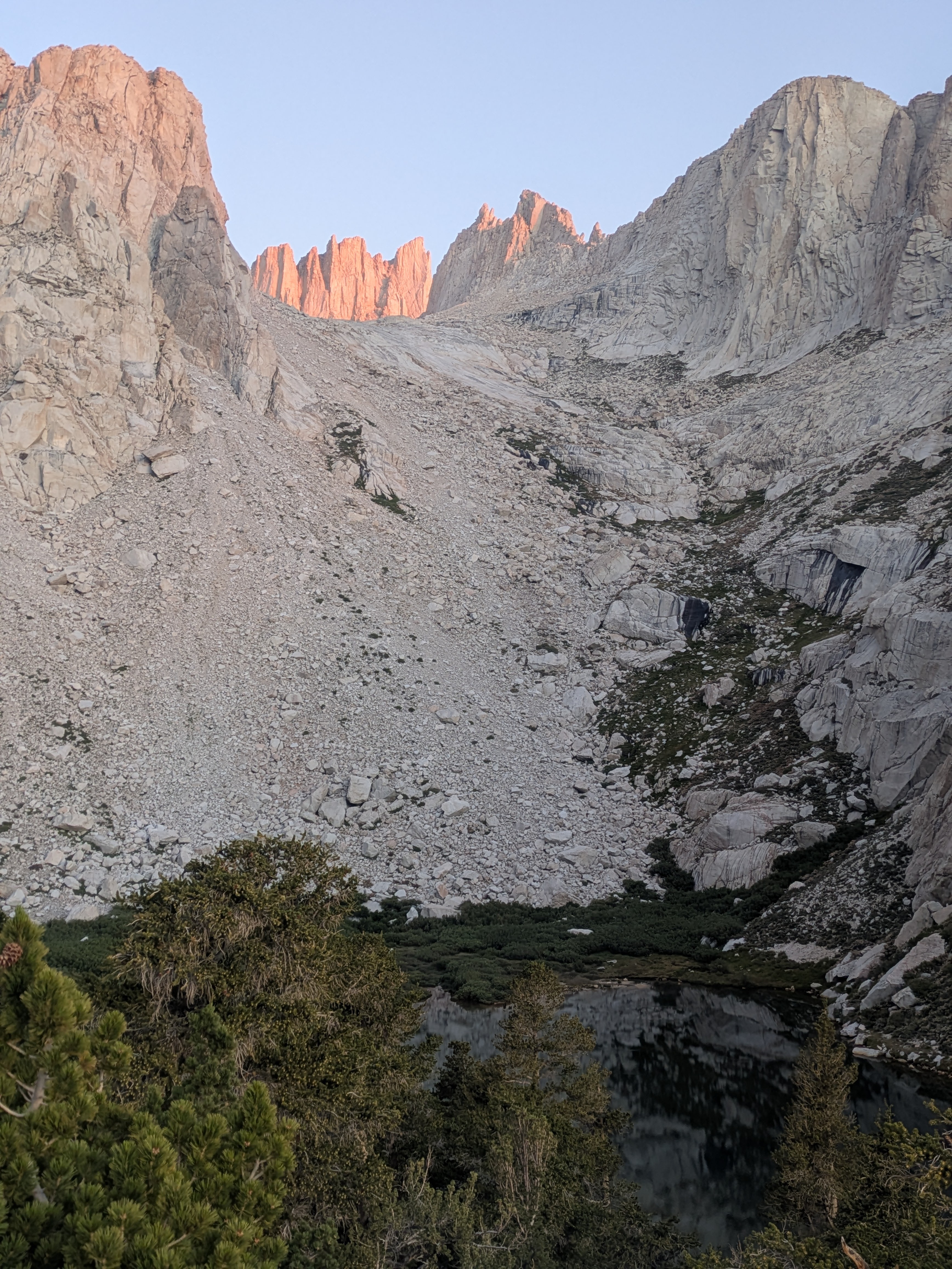
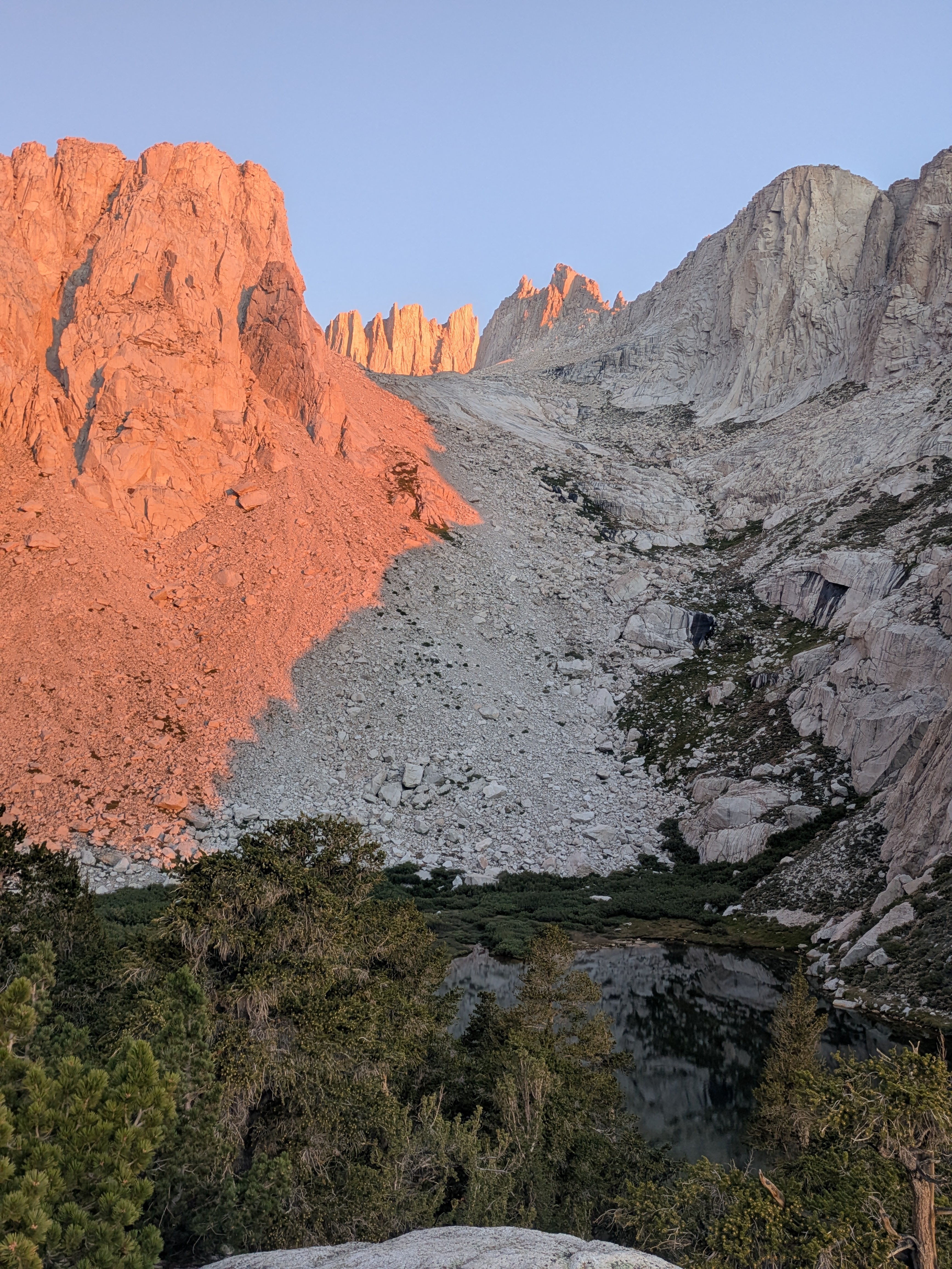
But what really gets your attention from Trail Camp is the view ahead.
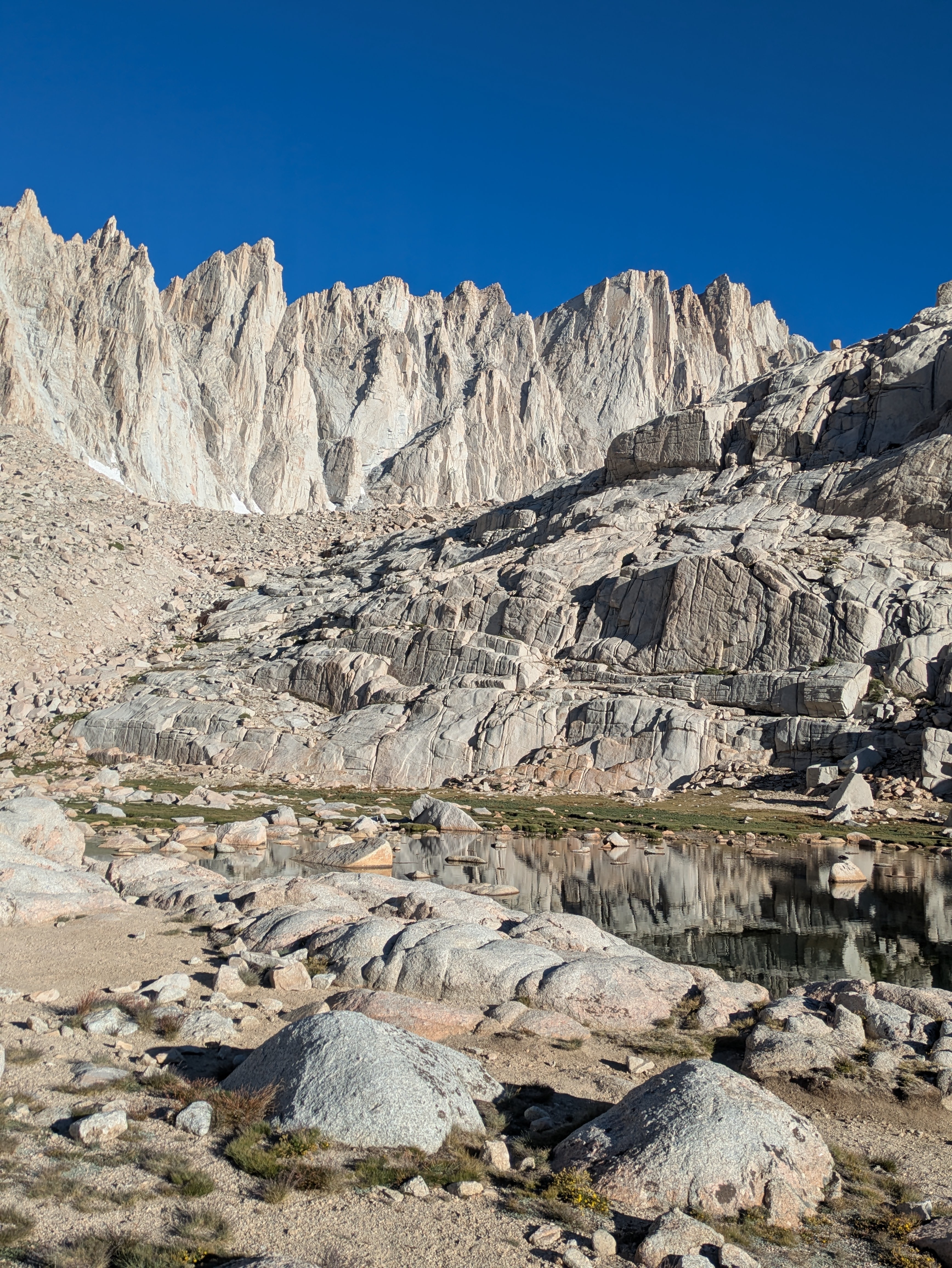
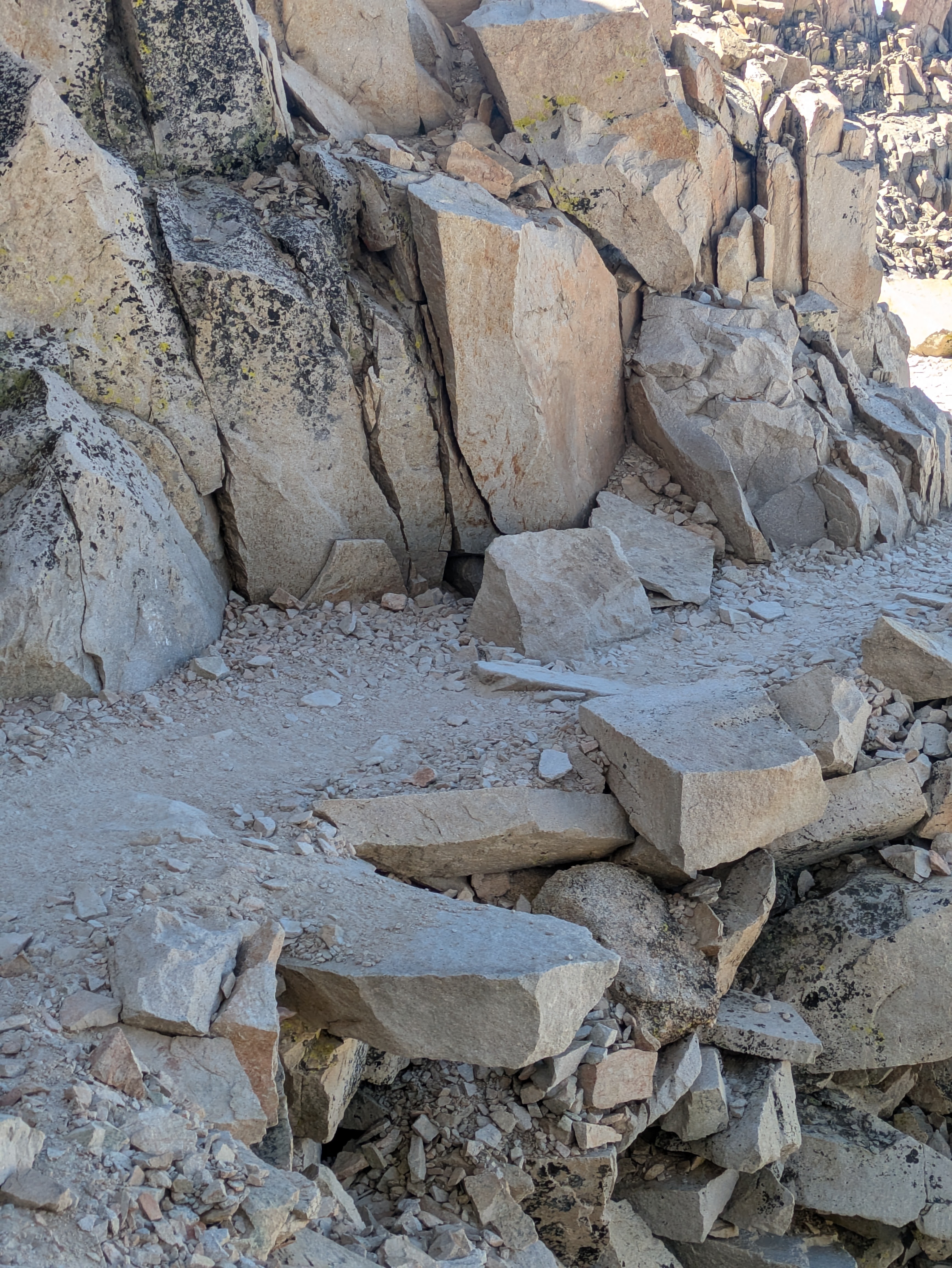
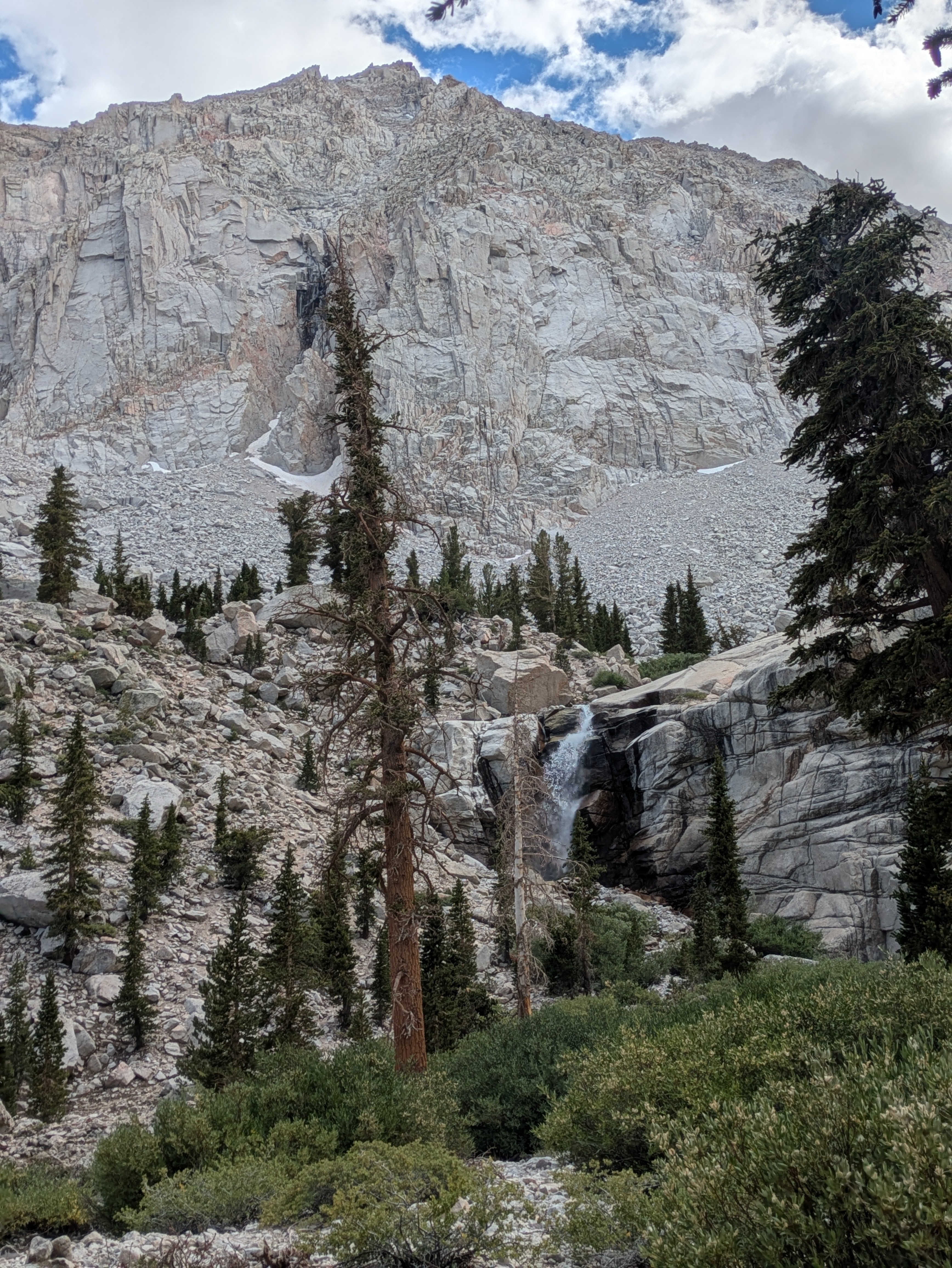
Above the lake rises a steep granite wall, and carved into that wall is the most famous part of the Mount Whitney Trail—the 99 Switchbacks.
For months, I had read about this section and watched videos about it online. In my mind, this was where my hike would probably end. I expected to climb partway up before deciding that was far enough.
Instead, I told myself to just keep going a little farther.
Then a few switchbacks later, I said the same thing again.
And again.
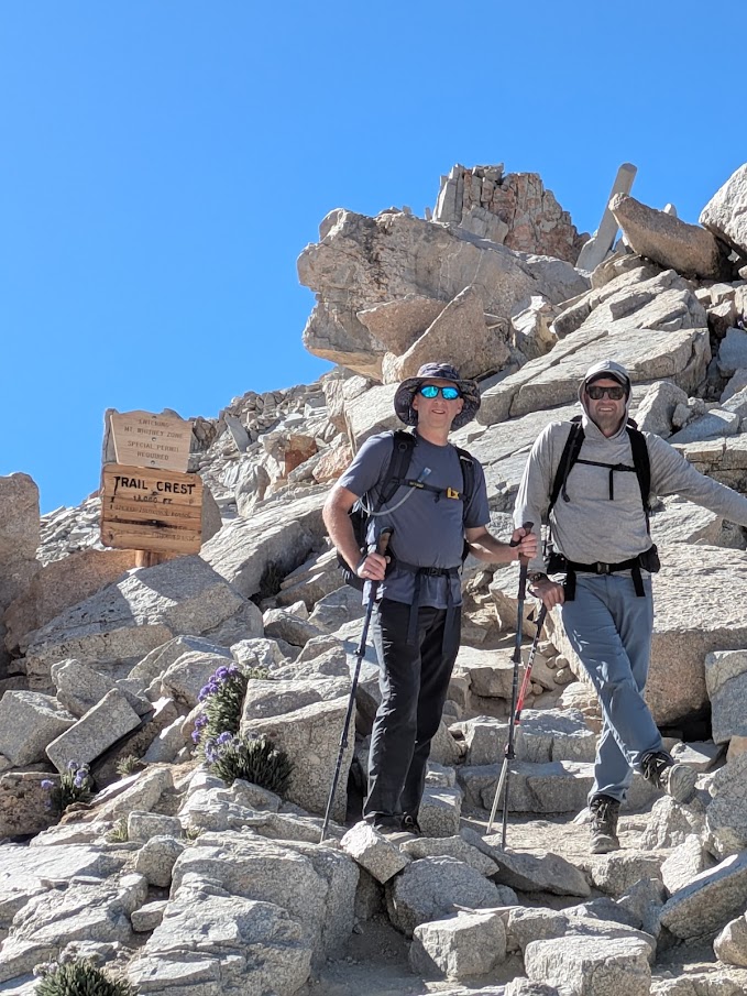
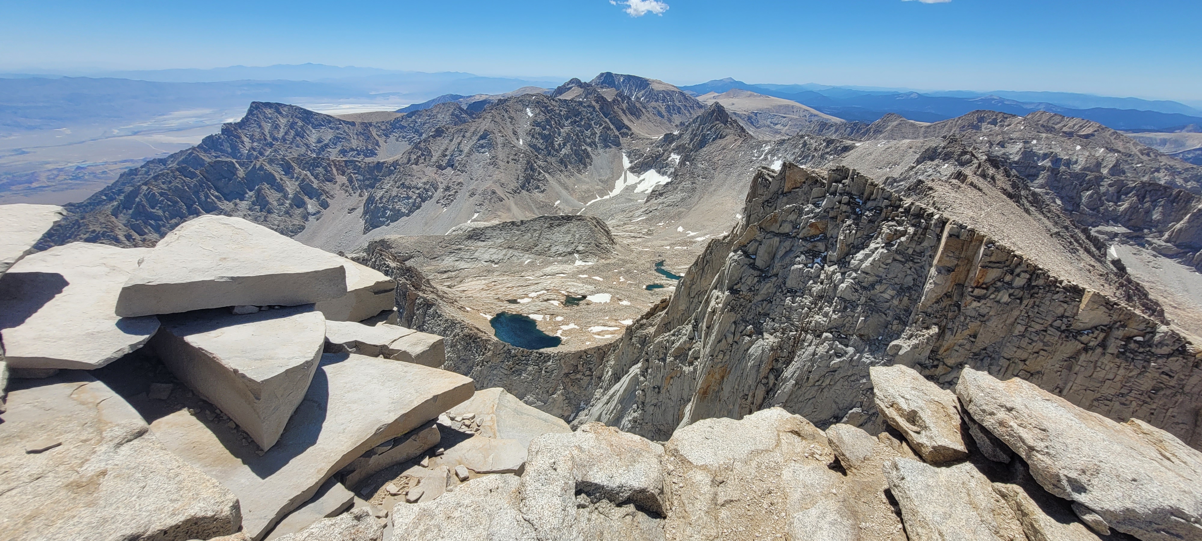
The climb is steady and relentless, zig-zagging up the granite face. It’s challenging, especially as the air gets thinner. But slowly—step by step—you gain elevation until you finally reach Trail Crest at about 13,600 feet.
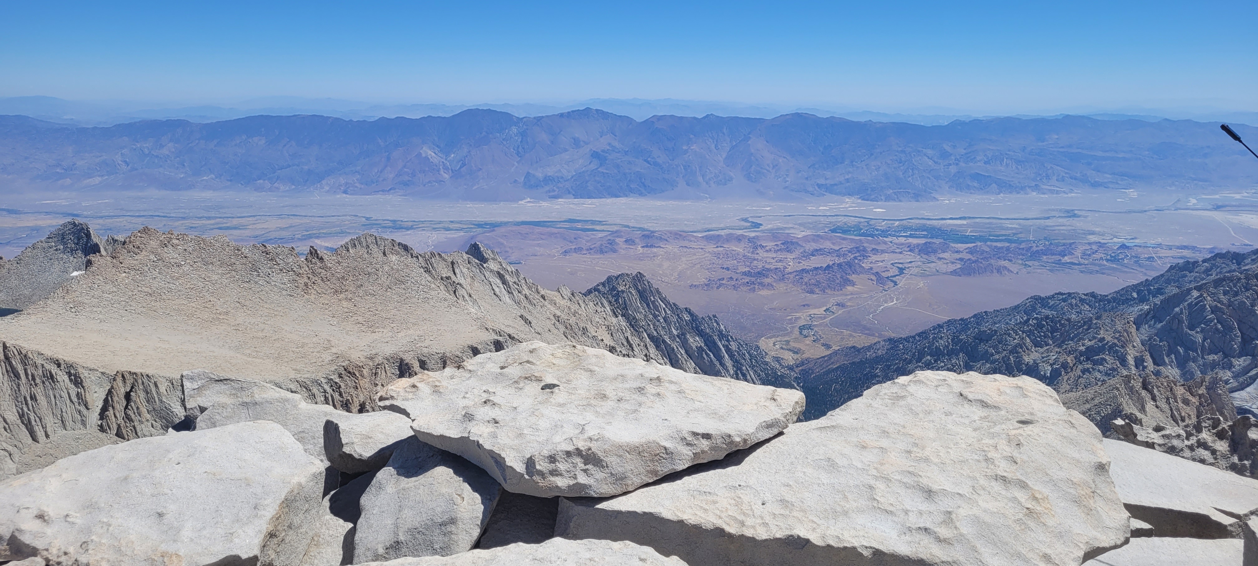
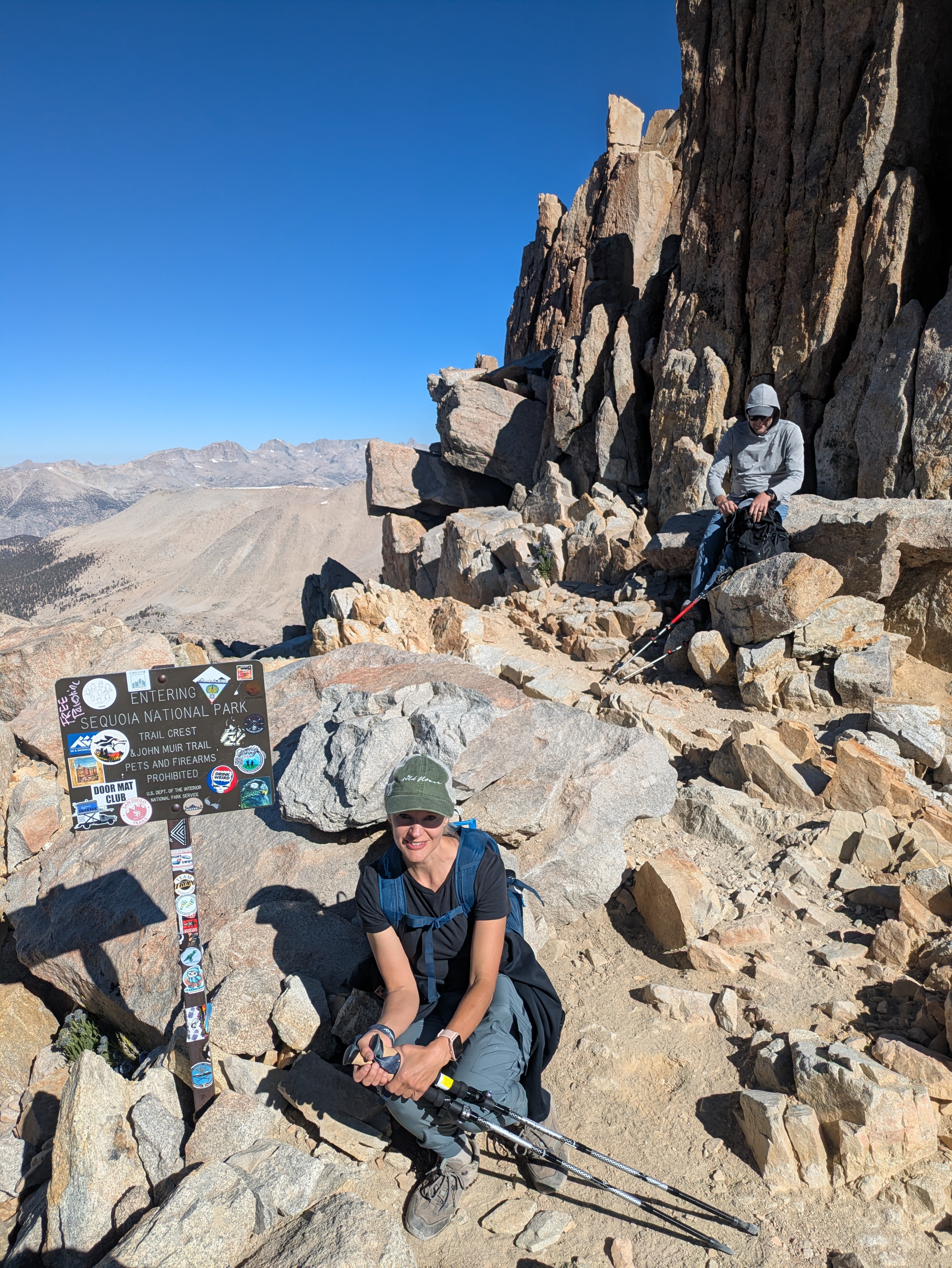
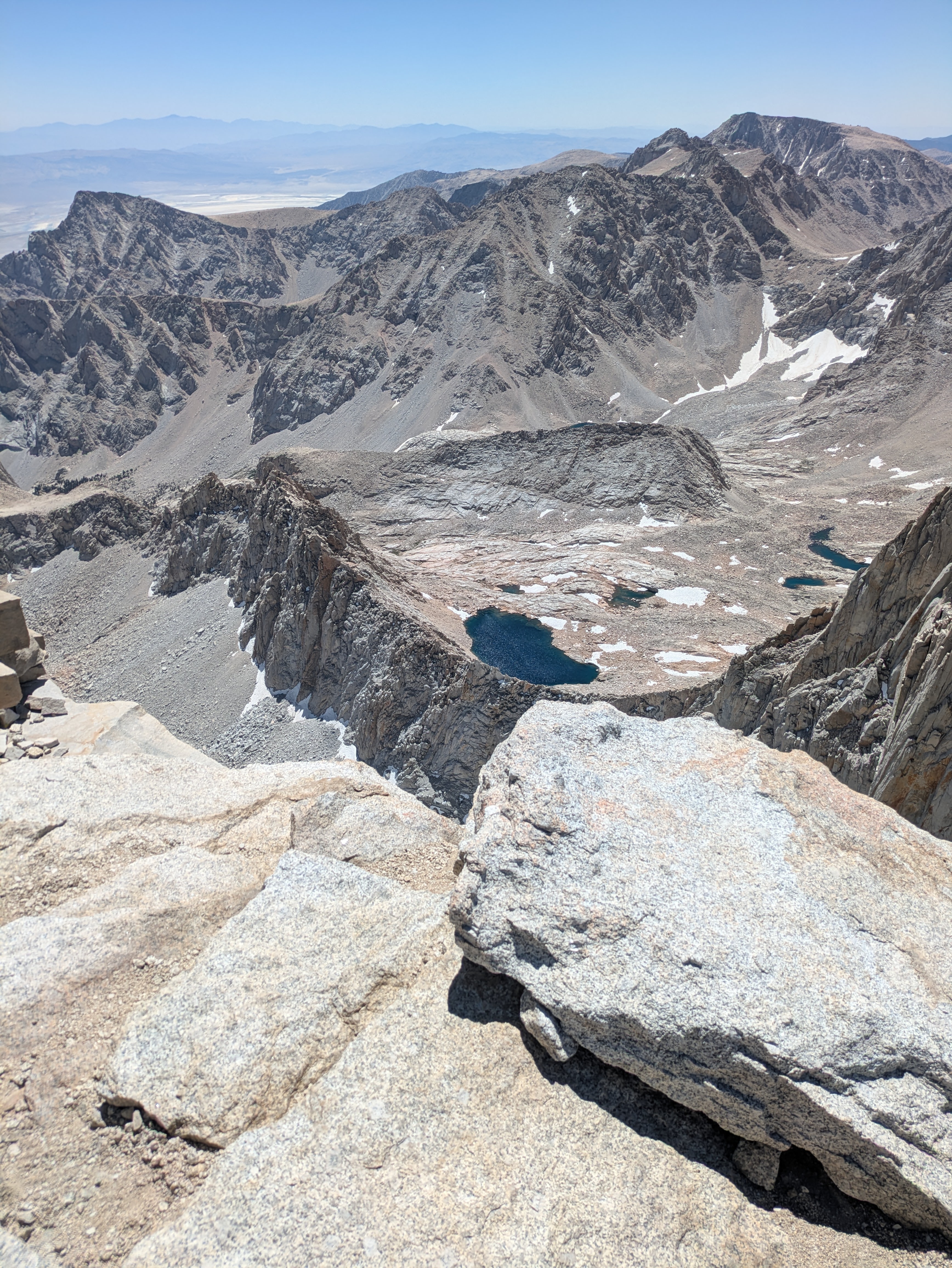
From Trail Crest you get an incredible view into Sequoia National Park on the west side of the Sierra Nevada.
At that point I had a realization.
If I had made it this far, I might as well keep going.
The Final Ridge to the Summit
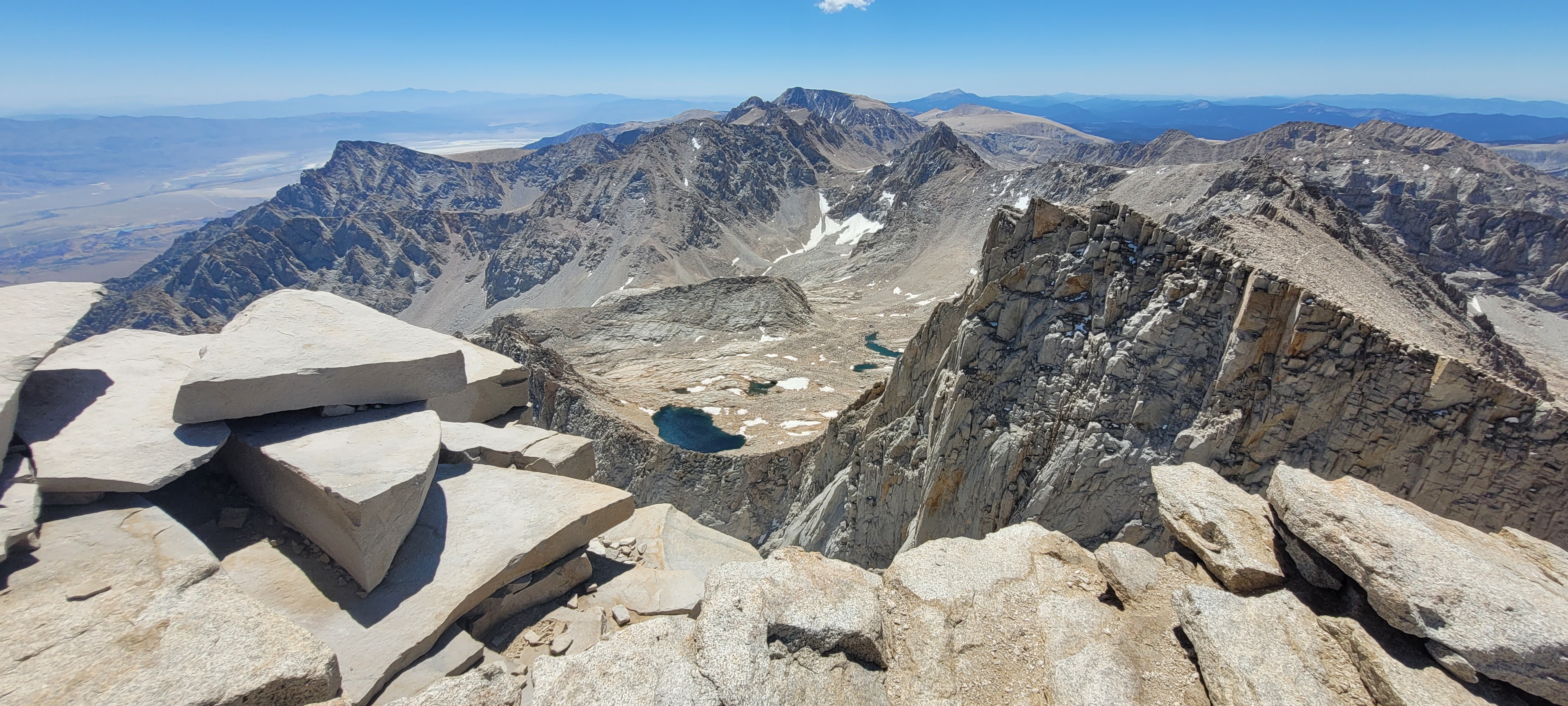
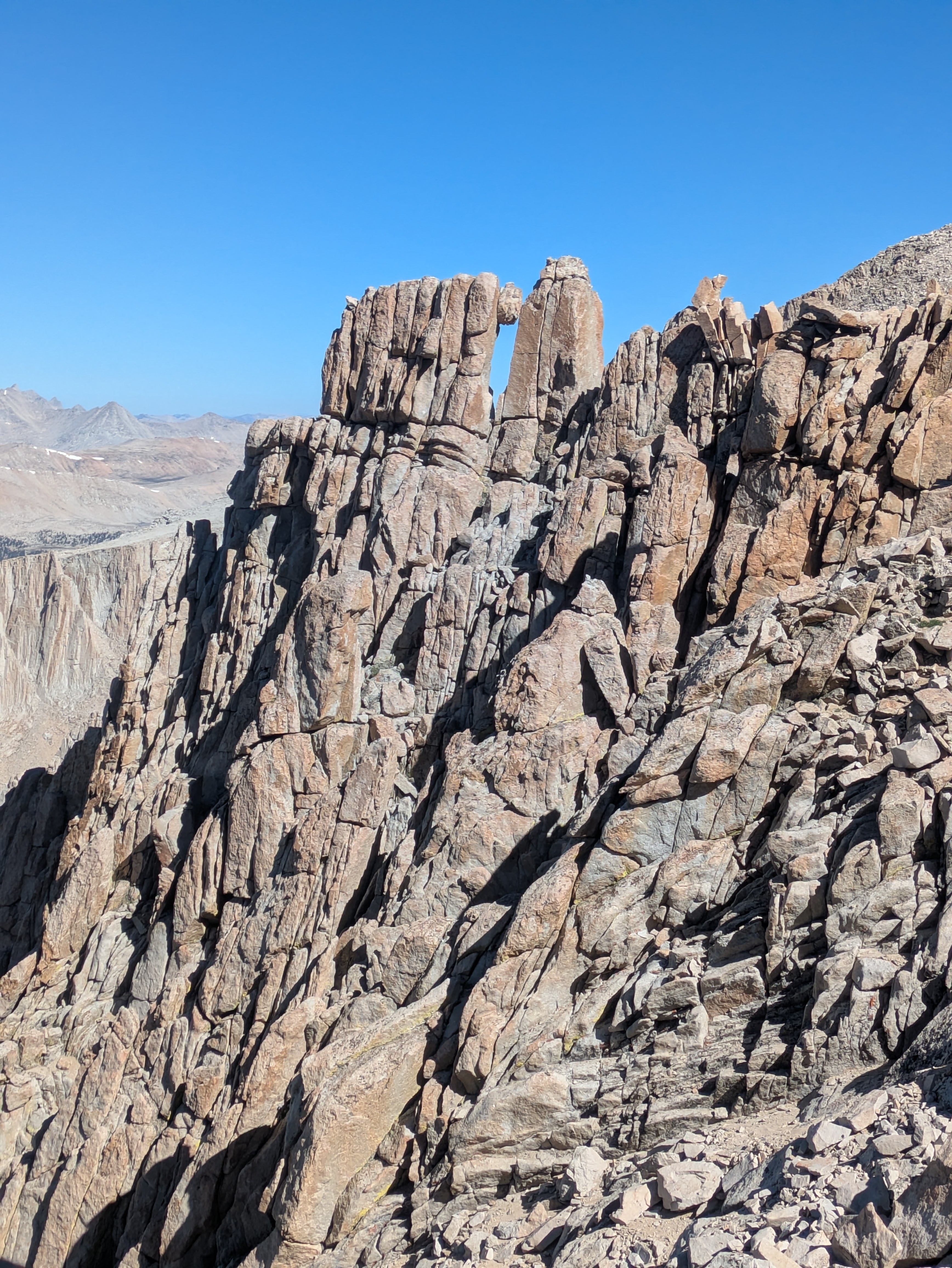
The final stretch of the hike runs along a high ridge toward the summit of Mount Whitney.
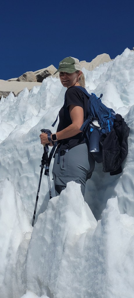
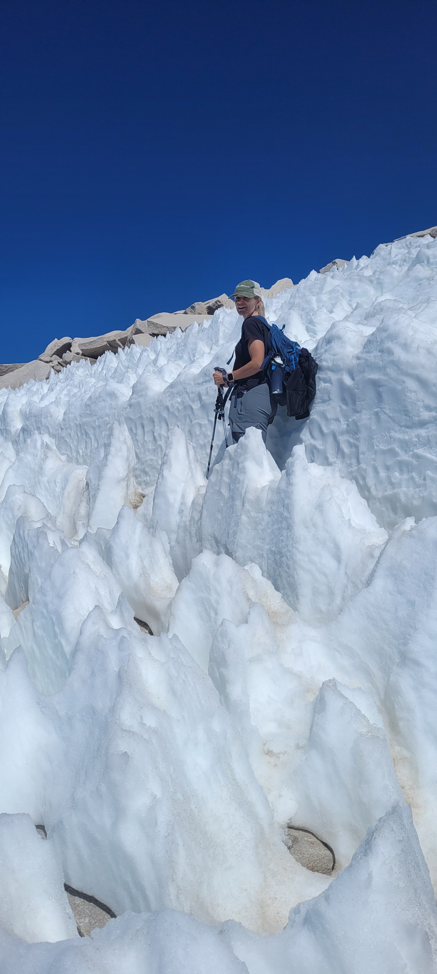
Technically, this section isn’t as steep as the switchbacks. But by that point in the hike, fatigue starts to set in. The air is thin, the miles are adding up, and the summit seems to take forever to get closer. You even pass through a stretch of trail covered in snow and ice – in July!
Honestly, this was where I struggled the most.
The trail itself wasn’t difficult. It just felt long.
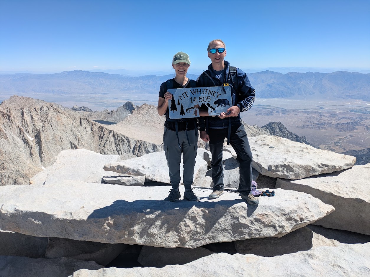
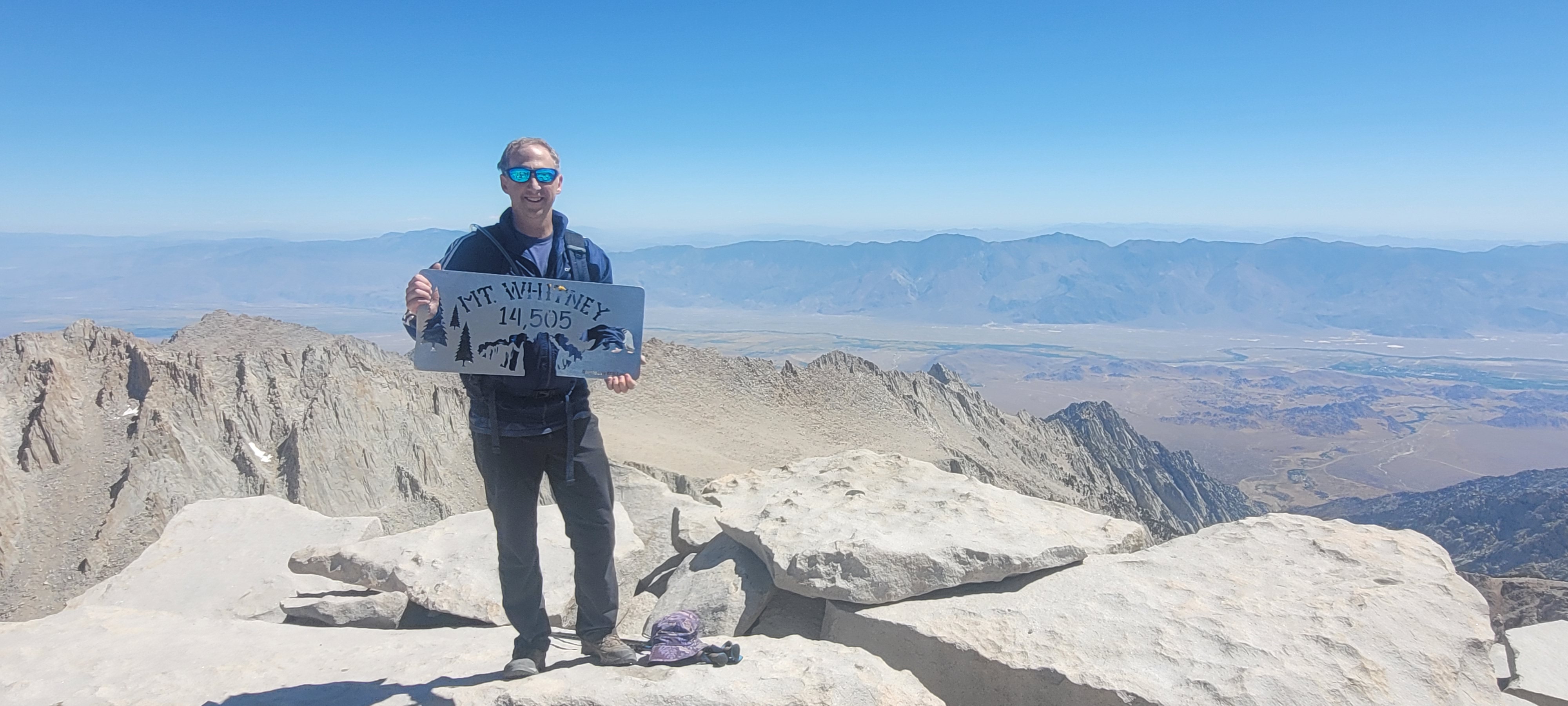
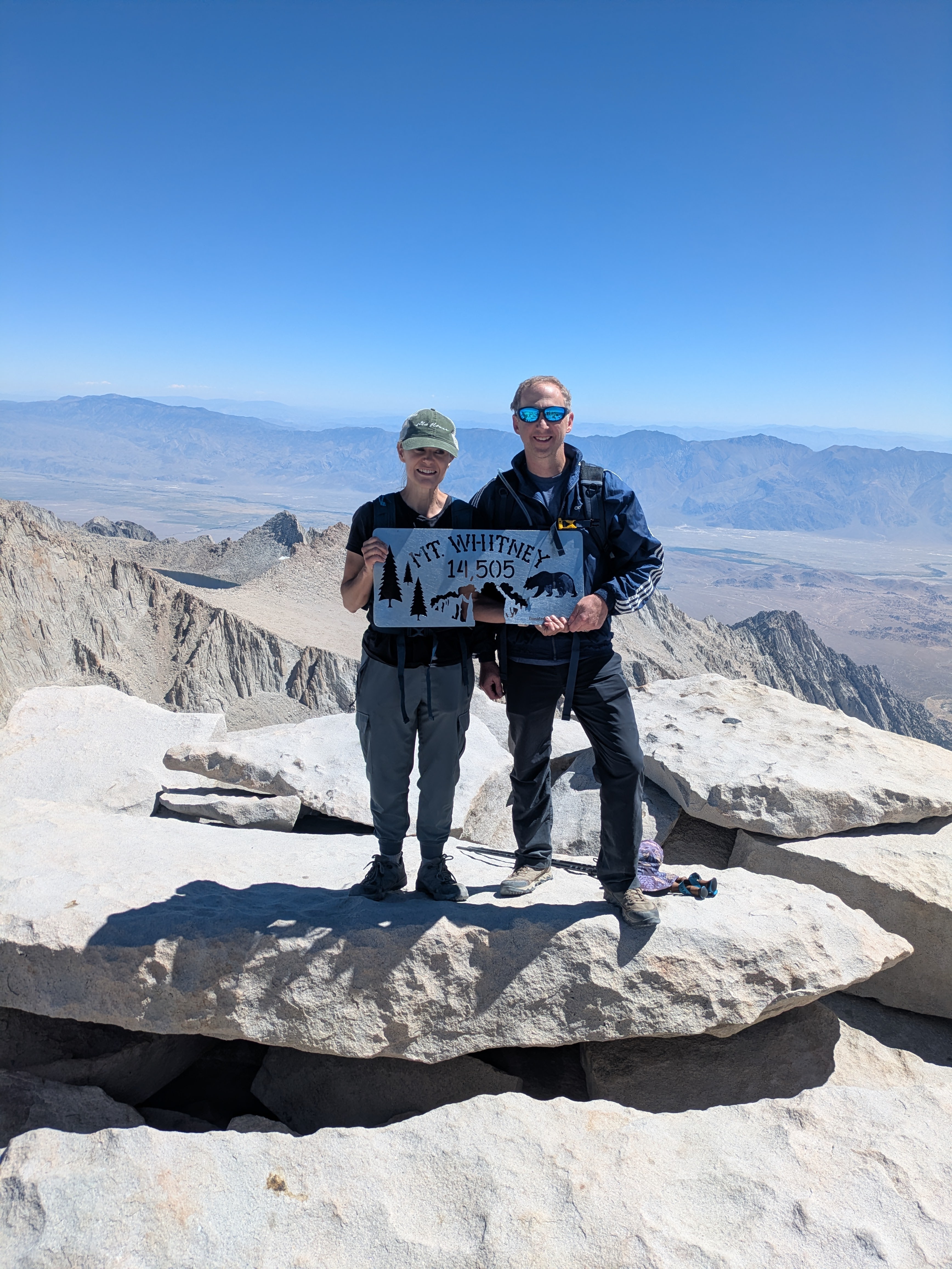
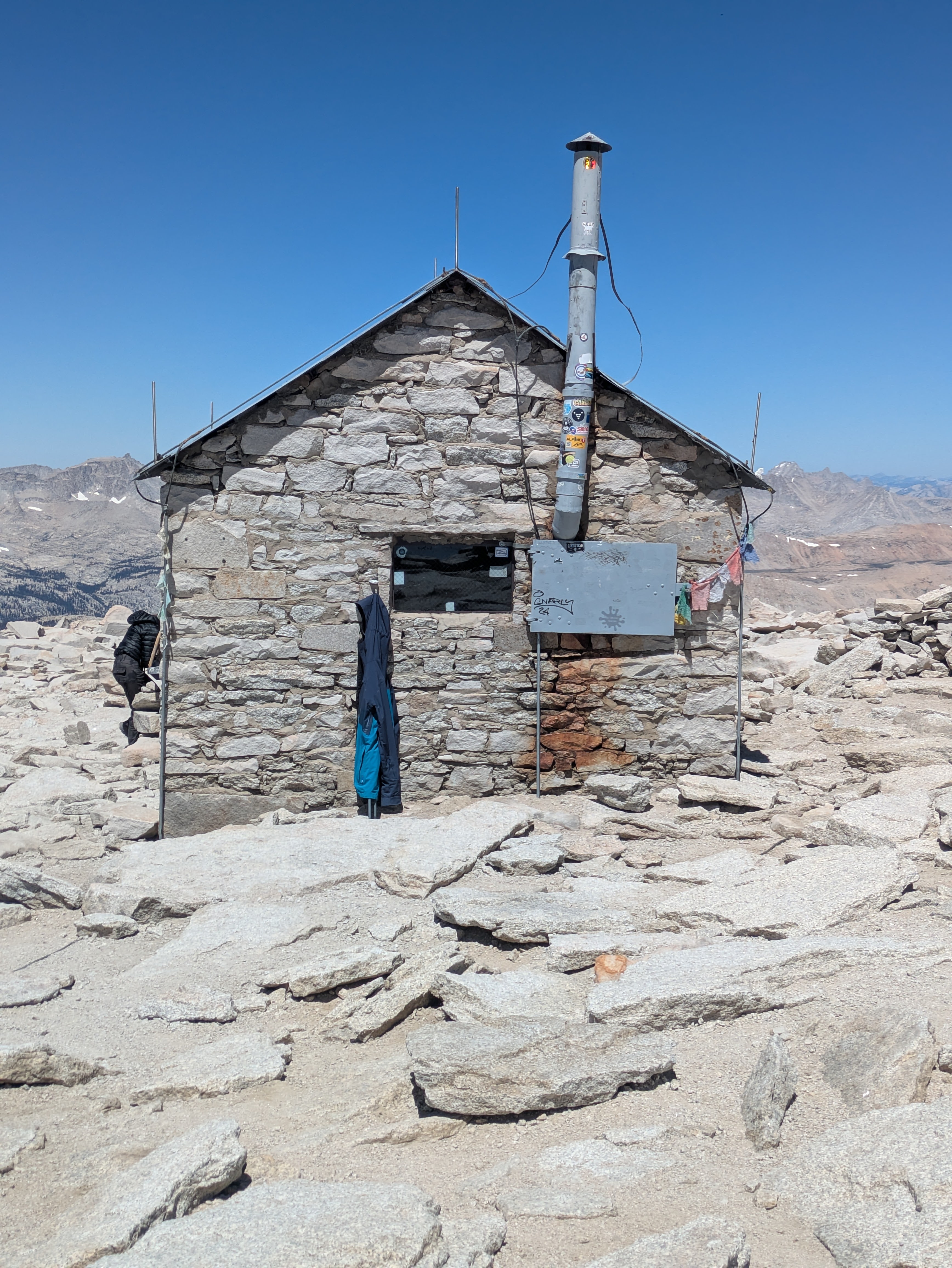
But eventually, after about 7½ hours of hiking, we reached the summit.
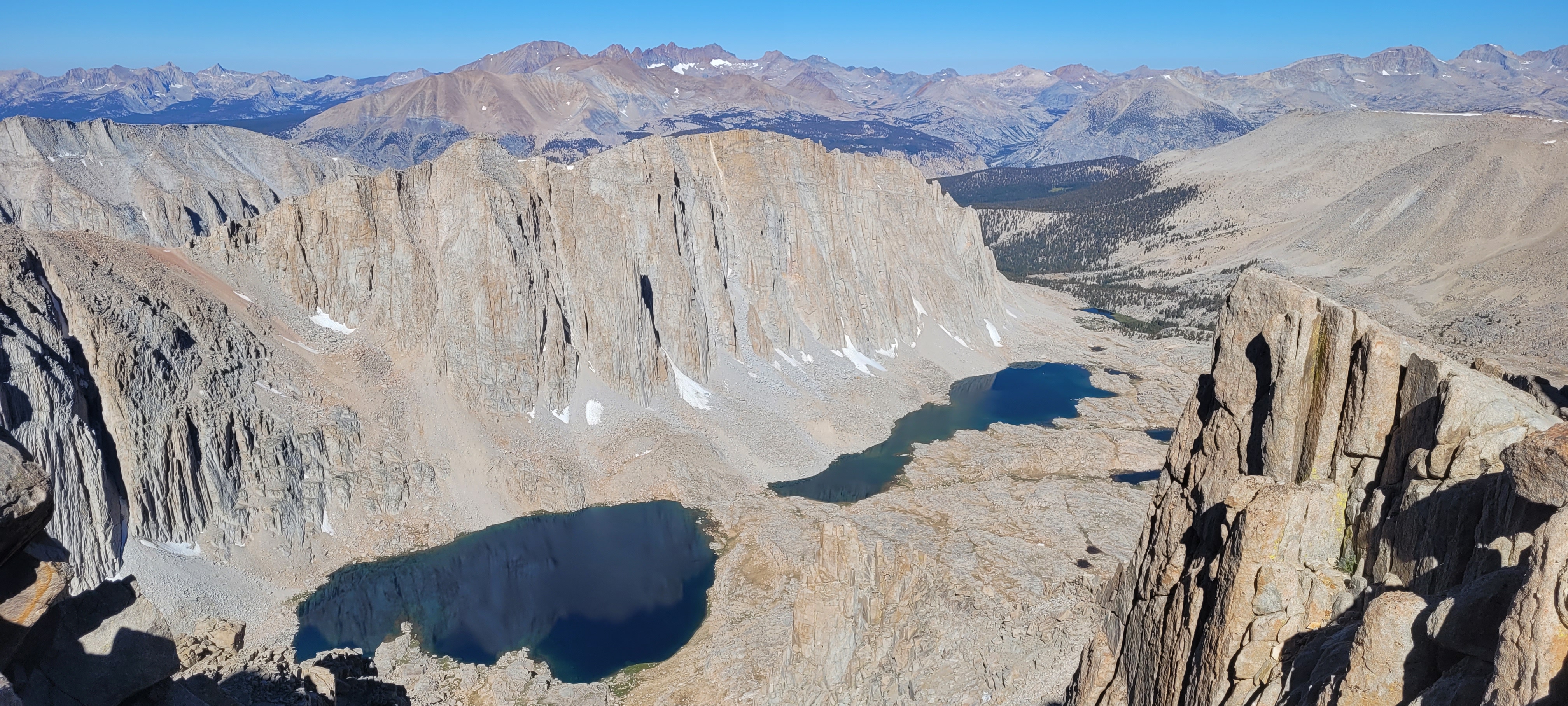
Standing on top of Mount Whitney is an unforgettable moment. At 14,505 feet, it’s the highest point in the contiguous United States, and the views stretch across endless ridges of the Sierra Nevada and the vast deserts of eastern California.
The sense of accomplishment is hard to describe. The physical exhaustion fades into the background, replaced by the realization that you actually made it.
For a moment, it really does feel like you’re standing on top of the world.
What I Loved Most About the Hike
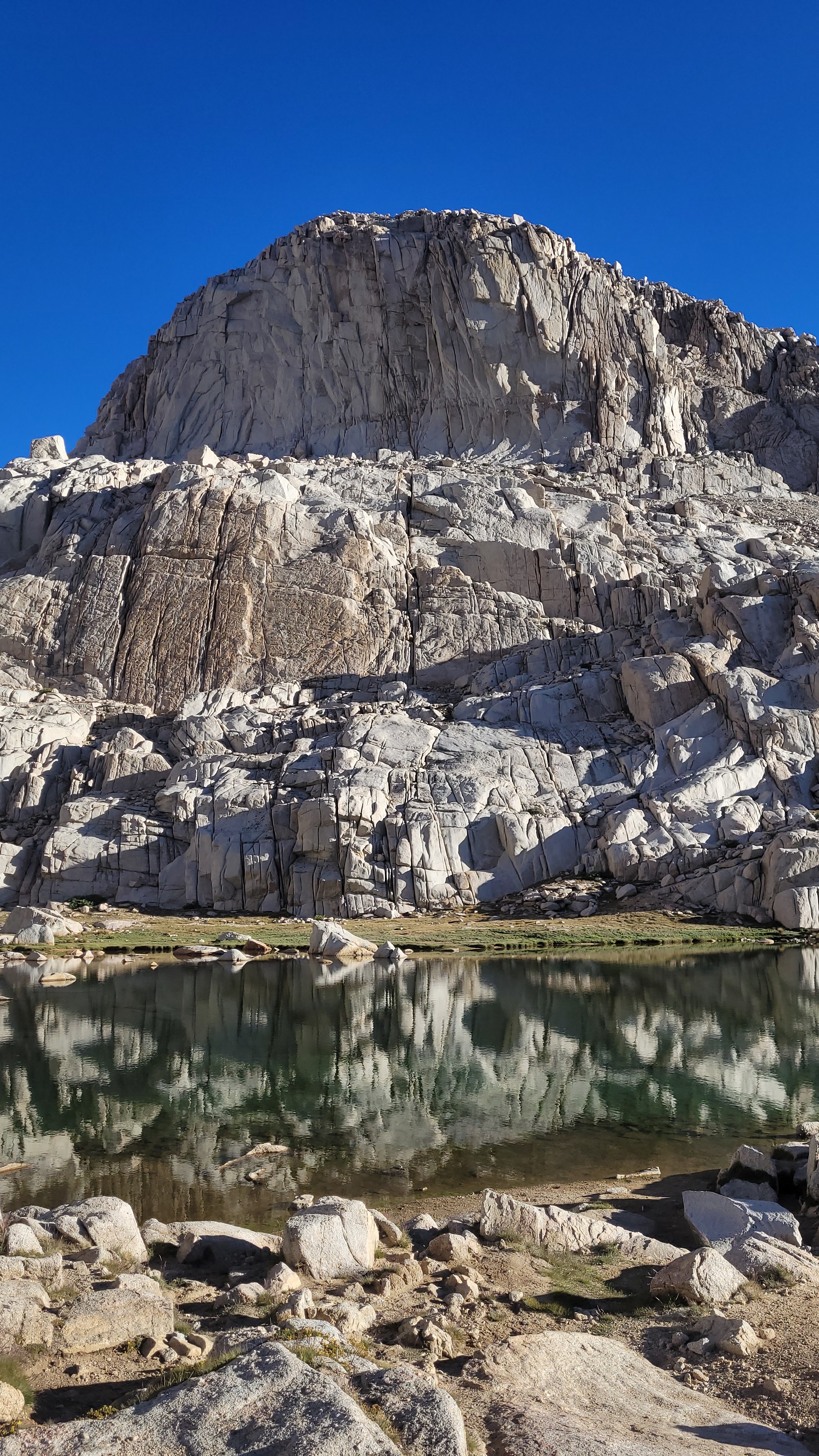
One of the most striking things about the Mount Whitney experience is the contrast in landscapes.
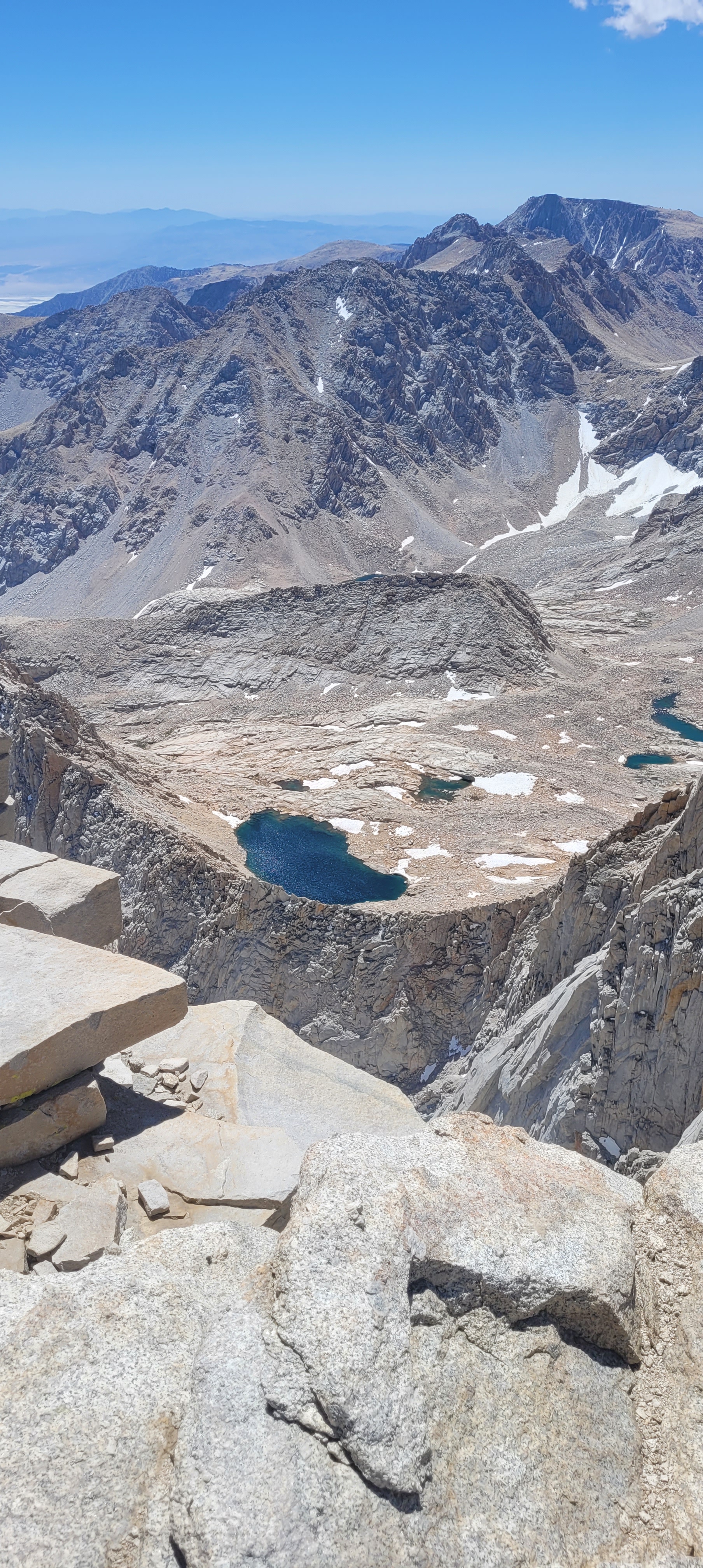
Just a few hours earlier we had been driving through the scorching desert around Death Valley. Now we were standing among alpine lakes, snowfields, and towering granite peaks.
Some of those lakes along the trail are incredibly beautiful. Seeing patches of snow and ice near Trail Crest—even in late July—while looking down toward the desert far below was a surreal experience.
Another highlight was the Whitney Portal campground itself. It’s crowded, but it’s clean, scenic, and incredibly well maintained. After finishing the hike, the food at the Whitney Portal Store tasted amazing—though that might have had something to do with the fact that we had just hiked more than twenty miles.
A Few Things to Know Before You Go
The biggest challenge for most people isn’t necessarily the hike itself—it’s getting the permit.
The Forest Service only allows about 100 day hikers per day on the Mount Whitney Trail. Permits are issued through a lottery system, and they can be difficult to secure. That’s actually why we ended up doing the hike in one day in the first place. It was the permit we could get.
Another thing to take seriously is altitude.
Alicia and I didn’t struggle much with altitude sickness, though we did take a couple of Advil once we passed around 11,000 feet. That may have helped—or maybe we were just fortunate. Either way, altitude affects everyone differently, and it’s something you should never ignore. We passed several hikers on the trail who had to turn around because they weren’t feeling well.
Water is another important consideration. There are streams along parts of the trail, and many hikers bring a filter to refill along the way. The last reliable water source is near Trail Camp, so planning your hydration strategy is important.
Finally, timing matters. The best window for hiking Mount Whitney without snow gear is usually late July through early September. Earlier or later in the season can bring snow, ice, and more dangerous conditions.
Would I Do It Again?
Maybe.
But probably not in a single day.
Now that I’ve done it, I can confidently say I’ve proven to myself that I can reach the summit. If I ever return, I’d probably take two days and enjoy the scenery a little more along the way.
Still, the experience was worth every step.
Mount Whitney may be the tallest peak in the lower 48 states, but it’s also one of the most achievable for hikers who are prepared and willing to push themselves.
If you train, plan carefully, and respect the mountain, it’s an adventure you’ll never forget.
Pictures of the Mt. Whitney Summit Trail
Mt. Whitney Summit Trail Highights
- The sense of accomplishment I got from reaching the summit
- The sharp contrast between the desert of Death Valley, and the stunning mountain scenery of Mt. Whitney
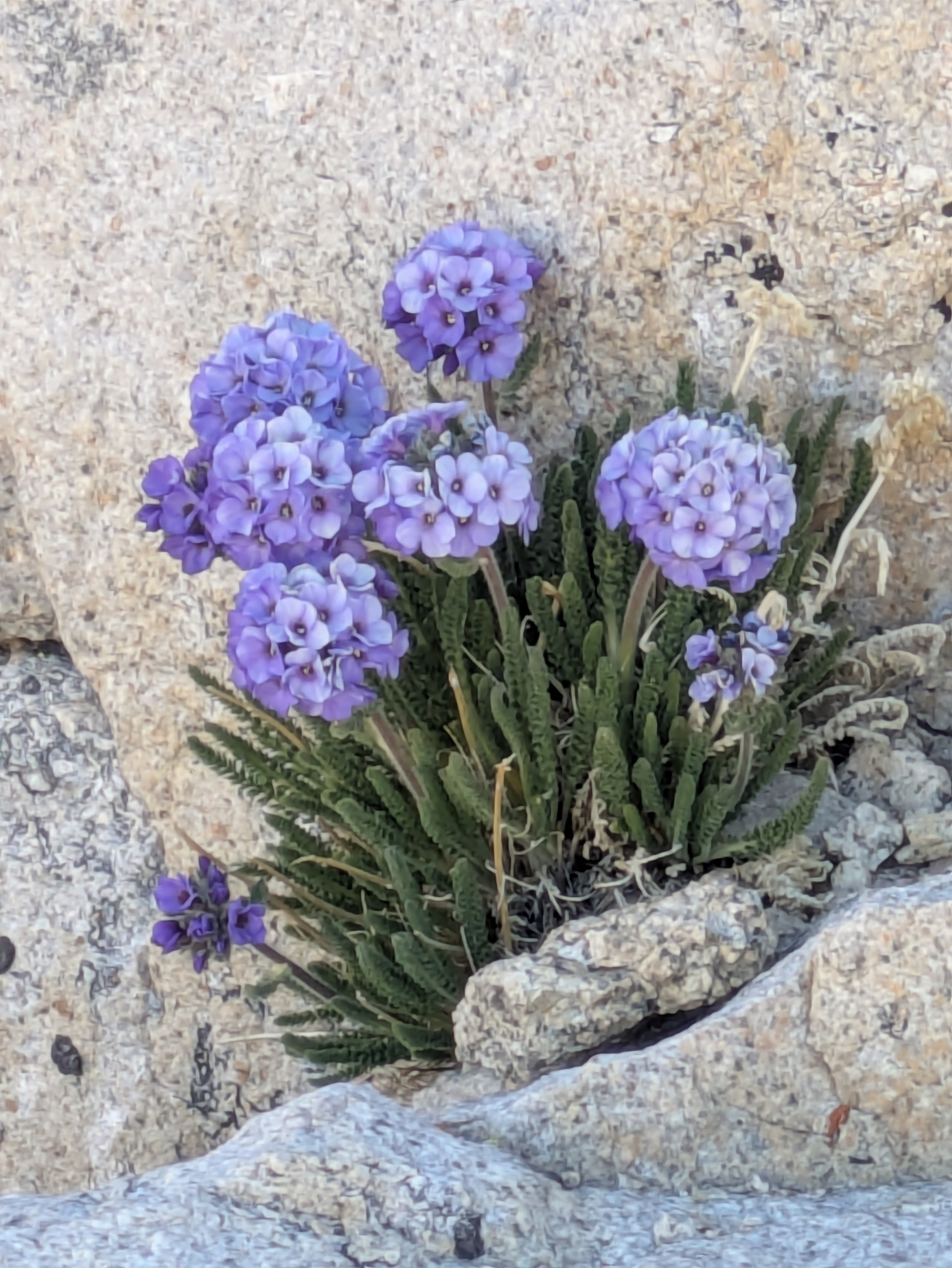
- The high mountain lakes are spectacularly beautiful.
- The snowy portion of the Trail Crest section was fun. Definitely different to walk through snow and ice at the end of July while overlooking the vast desert below.
- The Whitney Portal campground is one of the best public campgrounds I’ve stayed in. It’s clean. It’s pretty. The food at Whitney Portal Store is surprisingly decent (or maybe it’s because I was exhausted from the hike. Either way….
- Good water sources along much of the trail… .with the final dependable water source at Trail Camp.
What I don’t love about Mt. Whitney Summit Trail
Negatives: there aren’t a lot of negatives about Mt. Whitney, unless you count the strenuous nature of the hike a negative. I don’t.
- As beautiful as the campground is, they pack a lot of campers into a small space. No worries though. We were there to summit the mountain, not to spend time in a campground.
- The permit process is bear. They only allow 100 people per day on the trail. So, getting a permit is hard enough – which is partially why we had to settle for a single-day permit.
- Speaking of bears, be sure to lock up all of your food in bear boxes. The bears WILL find it – even if you leave it in a locked car. But that’s part of the fun, right?
- Watch out for altitude sickness. For Alicia and me, it wasn’t an issue. We popped a couple of Advil once we got to 11,000 feet or so, and that may have helped us. But honestly, we didn’t really struggle with the altitude Some people do though. It’s no laughing matter, and if you struggle with the altitude, don’t ignore your body. We ran into a couple of people on the trail who didn’t make it to the top because of altitude sickness. No judgement. Safety first!
Tips for success on the Mt. Whitney Summit Trail:
- The best thing you can do is to hike often in the months leading up to the hike. Do all sorts of hikes – short ones, long ones, ones with good elevation gains, and ones at high altitudes. We sought out peaks in our area that were 10,000 feet or higher and tried to hike them multiple times – just so we could get used to the elevation.
- Water. Water. Water. Don’t forget to drink water. We both took more than 2-liters, and we could have brought more. We brought a filter just in case, and a couple of people in our group did, in fact, stop to pump on the way back.
- Pick the right time of year. You have a short window of time for this hike if you want to avoid the snow and inclement weather. The end of July was perfect. Any earlier of later, and we might have run into rain, snow, wind, etc. The weather was perfect for us!
- Watch all sorts of videos to get yourself educated about the trail. Adventure Archives has a good video aout how to prepare. The Inspire to Go channel has a good video on hiking to the summit in one day. The Hiking Guy put out a great video about Mt. Whitney in 2026. I highly recommend his content, as he’s VERY detailed about everything he does. Very helpful!
- Be cautious and careful, but don’t be too intimidated about the fact Mt. Whitney is the tallest peak it the contiguous United States. It’s a startling fact. It’s impressive. But don’t let it scare you away. If you’re in decent shape, know what you’re doing and are well prepared, you can do this hike. Have fun and enjoy it!


Leave a comment