
Our Trail Rating
Just outside of St. George is a reservoir near the Shivwits Indian Reservation called Gunlock Reservoir. And just south of the lake is a trail, if you can call it that, that features dramatic vistas, red sandstone boulders, and just enough mystery to keep your mind and body occupied for as long you’d like. If you’re looking for a breezy walk in the park, this isn’t it. If you’re looking for a moderately difficult trail without a lot of people around, then let me tell you about what the Alltrails app calls Gunlock Loop.
There are two important things you need to know about Gunlock Loop. First, it’s not really a trail. It’s more of a general route that lets you choose your own adventure. Secondly, if you’re searching online for more information about this hike, don’t get it confused with the nearby Gunlock Slot Loop which starts exactly at the Gunlock Reservoir spillway and meanders through a nearby slot canyon. The two hikes are very different experiences. Both are worthy of exploration.
Finding the Gunlock Loop Trailhead
The Gunlock Loop trail starts at an unassuming trailhead along the creek bed roughly 1.5 miles south of the dam. From Gunlock Rd., find Road 0146 across from the water treatment facility and head eastward toward the creek. This short dirt road will lead to a parking along the creek.
Alicia and I started our adventure late in the afternoon, so we were well aware that we might have to cut our walk short due to the setting sun (a little foreshadowing there). We scampered down the shoreline into the dry river bottoms, all the while searching for some kind of a marked path or social trail. There wasn’t much to speak of. As we simultaneously kept our eyes on the small mountain ahead of us, and checked the map on our mobile devices, we realized the hike was about to take us on top of the red rock bluff. And then around the perimeter to complete the loop.
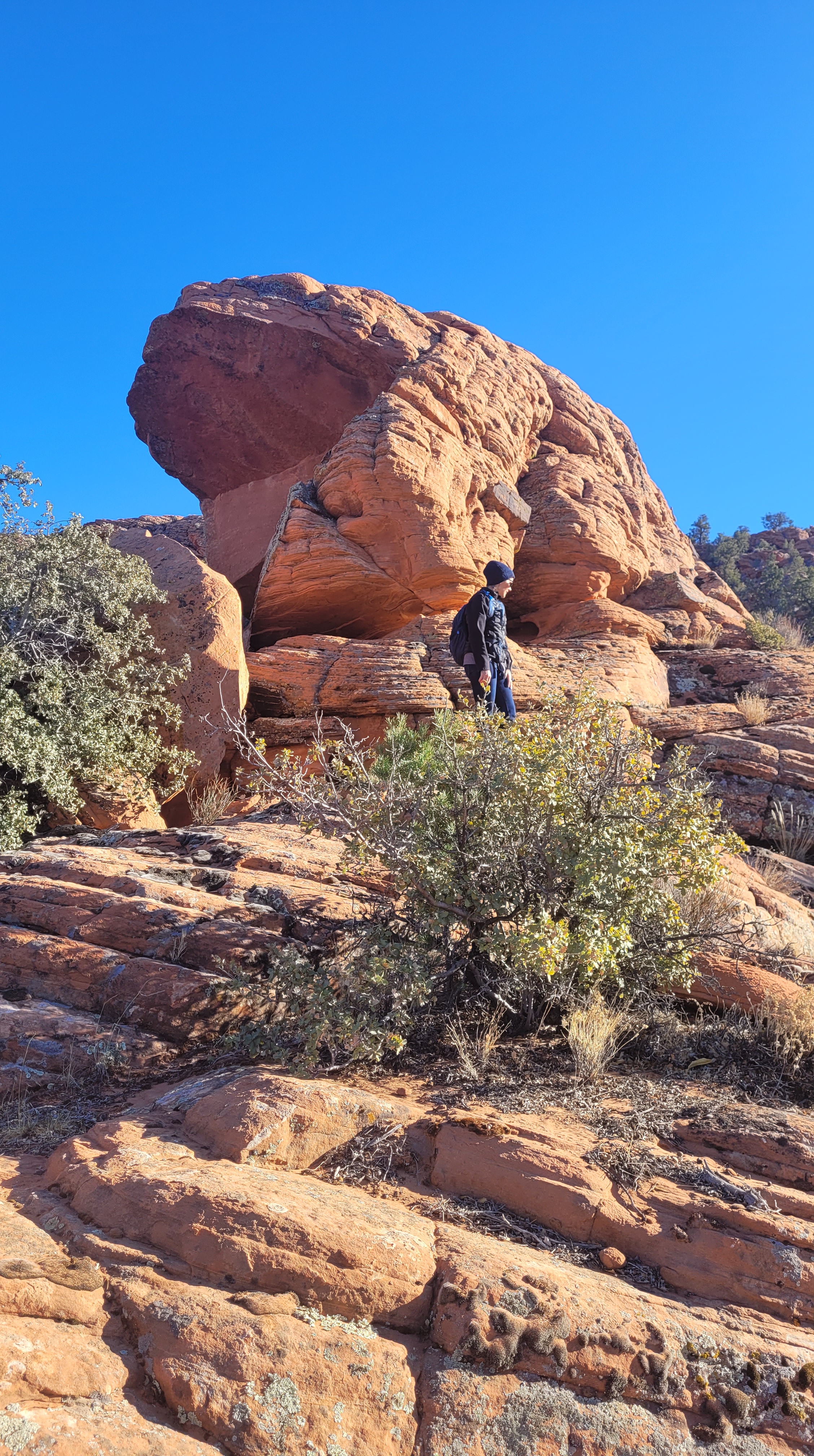
Finding our way up the mountain was an adventure in and of itself. We snuck our way through scratchy scrub oak. We stepped over and around prickly pear cacti. We brushed up against Navajo sandstone walls. As we ascended the hill, we climbed up and over sandstone and basalt boulders. Occasionally, we’d see a recent footprint and feel confident we were on the right path, only to discover we’d gone too far in one direction or another. No matter. There isn’t really a right way to do Gunlock Loop. The idea is to explore and appreciate what’s in front of you at any given moment.
Once on the top of the hill we took a moment to appreciate the gorgeous views. Gunlock Reservoir to the north. The Shivwits Reservation (a band of the Paiutes) to the south. Mile after mile of a desert landscape in every direction. And then it became glaringly obvious: the supposed trail is supposed to take us around the perimeter of this giant hill; we weren’t even halfway through and we were losing daylight. So, I did what any outdoor adventurer would do: I found a shortcut.
Looking toward the east I found a draw we could descend and basically cut our hike in half. It went well until we were almost cliffed out. Moving north, I found another way down the hill, and then another and another until we could see the creek bottom leading to the parking lot where we left our vehicle. Success!
When everything was said and done, we only hiked about three of the five miles we initially planned to tackle. Was it the easiest, most clear-cut hike we’d ever been on? Absolutely not! That’s what’s fun about the great outdoors. We improvised. We explored. We appreciated the beauty all around us: the red rocks; the green trees in January; the bright blue skies, and the strength within us to forge our own way and go where very few people venture to go.
The Pros:
- Gunlock Loop is a relatively short drive from St. George – about 30-minutes from downtown.
- The red rock scenery is beautiful
- This isn’t a heavily-trafficked area. The only person we ran into was a van life camper who had set up camp at the parking area.
- It’s close to Gunlock Falls, which is a major “plus” if the falls are running below the dam – usually in springtime after a wet winter.
The Cons:
- This isn’t really a trail. If you’re looking for a well-marked path to keep you headed in the right direction, choose a different hike.
- If there’s water in the creek – and that’s a big if – crossing the creek to get the mountain portion of the hike can be difficult.
- There are portions of deep, soft sand you’ll need to negotiate.
The gear:
- Basic hiking gear: durable shoes, trekking poles if you like using them, a hat – especially in the summertime.
- Water. This kind of goes without saying when you’re hiking in the desert.
- A GPS map and/or compass is helpful to keep you headed in the right direction.


Leave a comment