
Discover the stunning beauty and tranquility of Cedar Breaks National Monument in Utah.
I reached the parking lot a little after 2 o’clock after scrambling up the last 50 yards from the rocky creek below. Good thing, too! The temperature was rising quickly – low 90s and not a cloud in sight. But I couldn’t shake the thought, “Why don’t more people know about this?” The 11, 12, or 14-mile hike from Rattlesnake Creek to Ashdown Gorge east of Cedar City is a true gem. If you’re looking for a nearby one-or-two-day backpacking trip relatively close to civilization but away from the crowds in the nearby national parks, this is quite likely the best route I’ve ever found.
We began our adventure on a Friday, arriving at the trailhead just a stone’s throw away from the Brian Head ski area. In fact, you can see the mountain from the trailhead parking lot on the north side of UT-14. There’s a big sign along the fence line telling you where to go – you can’t miss it. Big, gray puffy clouds floated above us, but we didn’t think much of it. We strapped up, hefted our packs and hit the trail in quick order. You never know what to expect from Mother Nature when you’re at 10,000 feet of elevation in southern Utah. Lucky for us, we heard some thunder in the distance, but only felt an occasional sprinkle as we descended the mountain along the northern edge of Cedar Breaks National Monument.
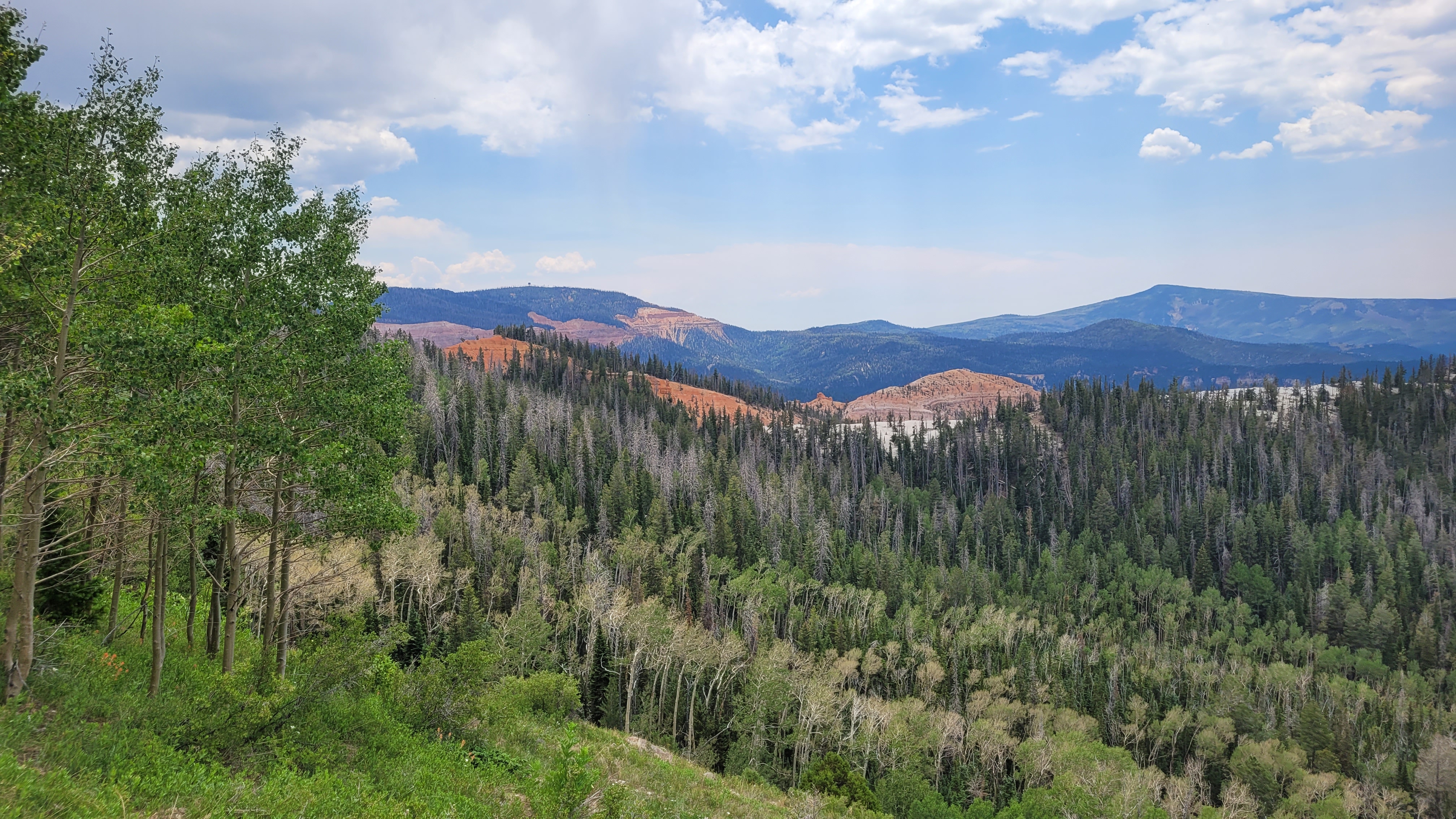
Cedar Breaks is a wonder in and of itself. The views are spectacular! You start down the trail through a meadow-like mountaintop surrounded by green pine trees and white quaking aspens. And then out of nowhere, you catch a glimpse of the red, white, and orange cliffs against the blue and gray skies. As you can imagine, it’s a kaleidoscope of color all around you. I’ve never seen anything quite like it. There are some side trails you can take along the way to get closer to the breaks if that’s your thing.
We followed the trail along Rattlesnake Creek for about 5 miles and then turned eastward along Ashdown Creek. We continued for about another mile before finding an established campsite near the creek bank with plenty of trees for hanging hammocks. No rain. No lightning. We lucked out.
Day two was another adventure. We started to follow the map marked out on Alltrails. I love that app, but sometimes….
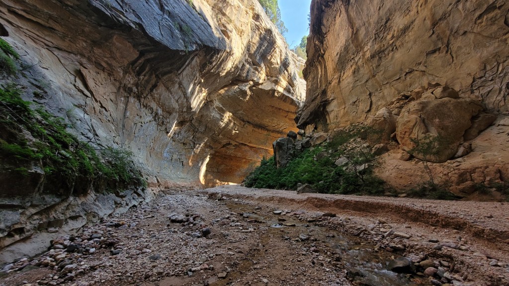
Anyway, we decided to turn back and proceed down Ashdown Creek instead. Boy, am I glad we did! Ashdown Gorge – obviously cut by the waters from Ashdown Creek –reminds me of a smaller Narrows in Zion National Park, but with a lot fewer people! The rocky creek flows through the slot-like canyon with towering, layered walls on either side. Occasionally, we’d come across cave-like alcoves where the water had washed out the rock over time. It was evident that flash floods and spring runoff had drastically taken their toll.
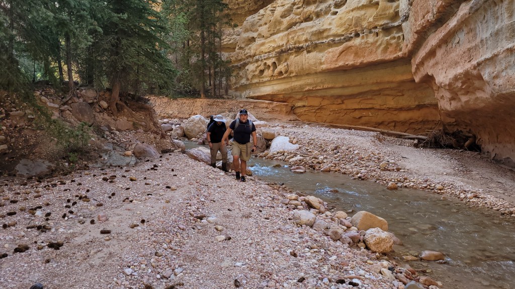
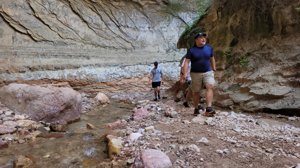
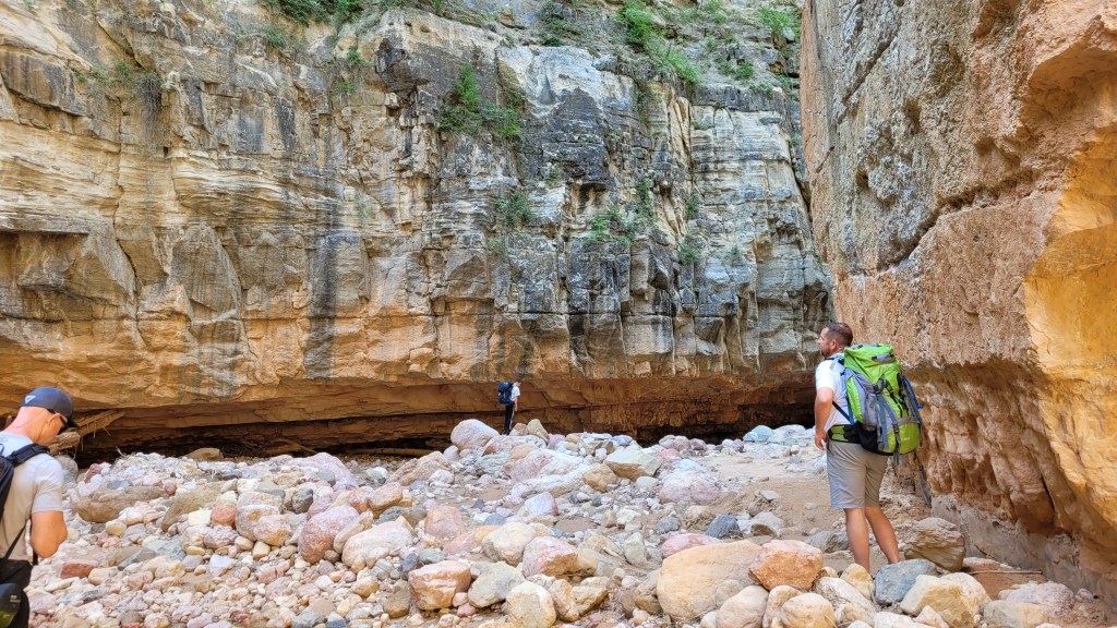
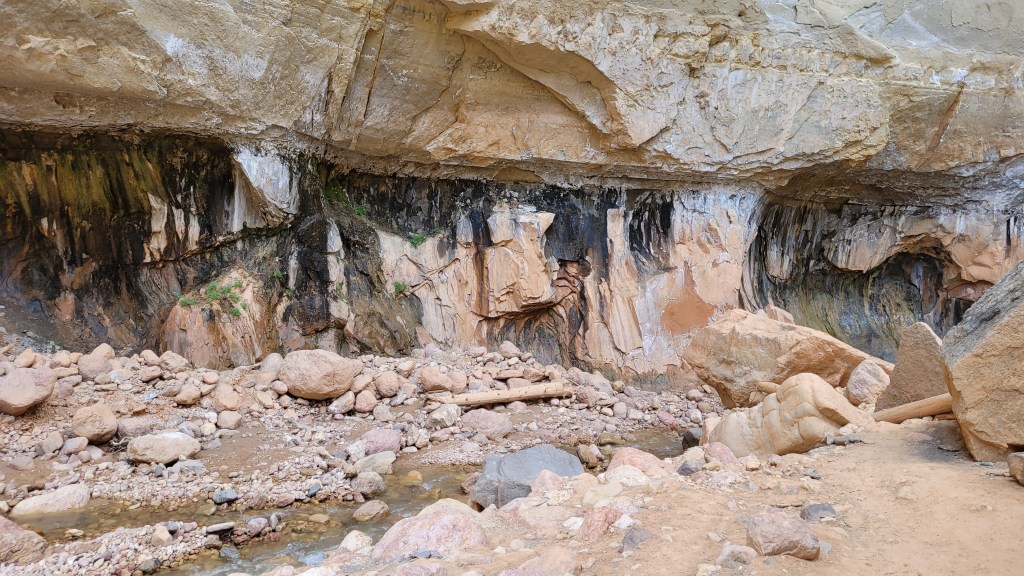
Once we left the campsite at Ashdown Creek we crossed the creek too many times to count. If you do this hike, count on walking in the water almost exclusively. You can try using neoprene socks, but if the weather is warm I wouldn’t bother. The water was never deep enough to swim (we went in July). Most of the time, the water was from our ankles to mid-calf.
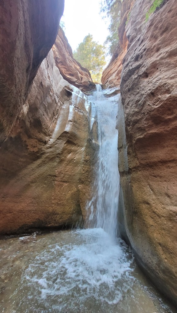
Upon arriving at the confluence of Ashdown and Rattlesnake Creeks, we dropped our packs and hoofed it up Rattlesnake Creek to explore two beautiful waterfalls. That’s where we met the first people we’d seen in 24 hours. They had come from the parking area on UT-14 where we had left a shuttle vehicle and hiked upstream – something I’ll likely do another day just to see the waterfalls again. I’d guess it’s about half a mile from the confluence to the waterfalls. Easy stuff, but well worth it.
We returned to our packs and continued the rest of the way down the creek. We passed a few groups here and there who were headed upstream. Evidently, some people know about the waterfalls, but very few go any further.
After a quick scramble up the tall creek bank to the parking lot along the highway, we dropped our packs and rested in the hot sun while a few of us drove back to the trailhead to retrieve the vehicles. I recommend the shuttle method instead of hiking this as an out-and-back.
Depending on whose device you believe (Apple vs. Android), we hiked anywhere from 11 to 14 miles over two days. The terrain was mostly easy, with a sometimes painful downhill hike to the camping area at the bottom. There are some areas where you’ll need to duck under fallen trees and climb up and over boulders. But nothing to difficult.


Leave a comment